Why a Georeferenced Map is Essential for Property Buyers in Spain
Introduction
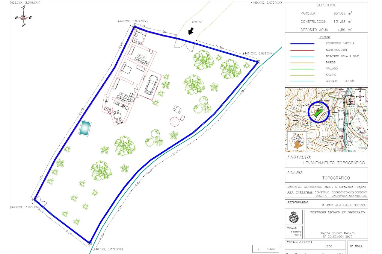
When purchasing property in Spain, buyers must consider numerous factors to ensure a smooth and secure transaction. One critical yet often overlooked element is the georeferenced map. This essential document provides precise details about a property's boundaries, legal status, and environmental impact, offering buyers a clearer understanding of their investment.
In this article, we explore why requesting a georeferenced map from the seller is a crucial step in the property-buying process.
Ensuring Legal Certainty and Clear Boundaries
A georeferenced map provides legally binding data regarding property boundaries, helping to prevent future disputes. In Spain, property limits can sometimes be ambiguous, making it essential to have accurate geographic coordinates. This document ensures that buyers acquire precisely what is stated in the contract, reducing legal risks and protecting their investment.
Understanding Urban Planning and Zoning Regulations
Zoning laws and urban planning regulations significantly impact a property's use and potential modifications. A georeferenced map reveals any building restrictions, zoning classifications, or future development plans imposed by local authorities. This information is vital for buyers looking to develop, renovate, or assess the long-term value of their investment.
Compliance with the Spanish Cadastre and Taxation
Property owners in Spain must ensure that their land's georeferenced coordinates match official cadastral records. Accurate mapping is essential for calculating property-related taxes, including:
- IBI (Real Estate Tax)
- Wealth Tax
- Inheritance Tax
If discrepancies exist between the property's actual size and cadastral records, a Cadastral Alteration procedure must be initiated. This can influence tax obligations and legal ownership records, making a georeferenced map a crucial tool for property buyers.
Assessing Environmental Impact and Sustainability
Spain’s diverse geography means that some properties may be located in protected areas, near water sources, or in environmentally sensitive zones. A georeferenced map helps buyers identify potential ecological concerns, such as flood risks or conservation regulations, ensuring responsible and sustainable property ownership.
Evaluating Infrastructure and Accessibility
The accessibility of a property significantly impacts its convenience and value. A georeferenced map provides detailed insights into:
- Road networks and transportation links
- Utility connections (water, electricity, sewage, etc.)
- Proximity to essential services like schools, hospitals, and public transport
For both residential and commercial buyers, understanding the surrounding infrastructure is essential for making informed decisions.
Conclusion
A georeferenced map is more than just a technical document—it’s a critical tool for ensuring legal clarity, regulatory compliance, and long-term investment security. Buyers in Spain should always request this document from sellers to avoid potential legal, financial, and environmental complications. By doing so, they can navigate the property-buying process with confidence and peace of mind.