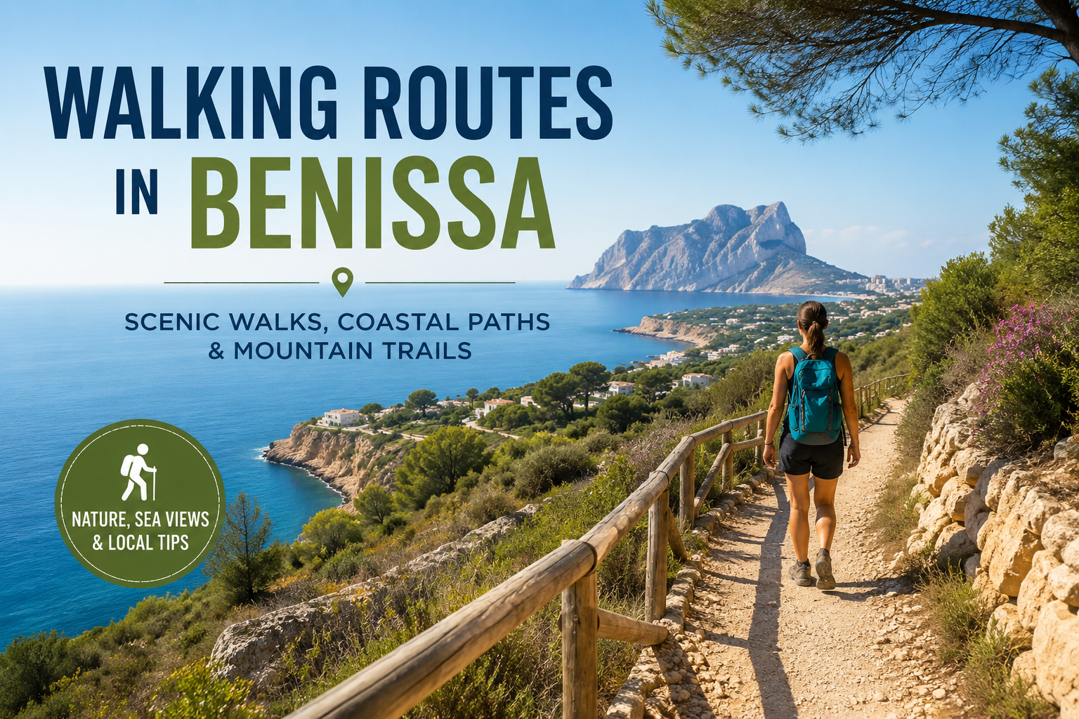
Walking Routes in Benissa: The Best Walks and Hiking Trails
https://www.teliohomes.com/en/blog/benissa-countryside/Introduction
The walking routes in Benissa offer a remarkably varied way to experience the Costa Blanca North. Within and around the municipality, you can walk beside Mediterranean coves, follow coastal cliffs, explore vineyards and traditional agricultural landscapes, discover historic riuraus and rural paths, or take on mountain routes through the Sierra de Bèrnia and Sierra de Oltà.
What makes Benissa particularly appealing to walkers is the contrast between its landscapes. Benissa Costa, including areas such as La Fustera, San Jaime, Fanadix and Buenavista, offers coastal paths, coves and sea views. Inland, around Benimarco, Pedramala, Pinos and the wider countryside, the landscape changes to vineyards, almond and olive trees, dry-stone terraces, farmhouses and historic rural routes.
There are also proper mountain hikes for experienced walkers. Benissa's official hiking network currently includes ten routes, ranging from easy trails to moderate mountain routes, with options covering the coast, countryside, heritage and surrounding mountain landscapes.
This guide focuses on six of the most useful routes for visitors, residents and property owners, while also explaining the wider Benissa walking network. You will find practical information about distance, duration, elevation, difficulty, terrain, scenery, families, dogs, parking, seasons and safety.
Route information: Route conditions, access, parking, signage and recommended itineraries can change. Always check the current official Benissa route information, weather conditions and GPX track before setting out. The technical figures in this guide are based on the current official route information available from Benissa Tourism.
Walking is also an excellent way to understand Benissa as a place to live. A property that looks close to the coast on a map may have a very different walking experience from one in the countryside. Exploring the area on foot gives you a better feel for terrain, views, surrounding development and the character of individual neighbourhoods.
Table of Contents
- The Best Walking Routes in Benissa at a Glance
- Walking Route 1 — Paseo Ecológico de Benissa
- Walking Route 2 — SL-CV 136 Ruta del Molí del Quisi
- Walking Route 3 — Ruta dels Riuraus de Benissa
- Walking Route 4 — PR-CV 388 Ruta dels Riberers
- Walking Route 5 — PR-CV 7 Sierra de Bèrnia
- Walking Route 6 — PR-CV 340 Sierra de Oltà
- Other Official Walking Routes in Benissa
- Coastal Walks in Benissa
- Countryside Walks in Benissa
- Easy and Family-Friendly Walks in Benissa
- Benissa Walking Routes by Difficulty
- Walking in Benissa With Dogs
- The Best Time of Year for Walking in Benissa
- What to Take on a Walk in Benissa
- Walking Safety in Benissa
- How to Choose the Best Walk in Benissa
- Frequently Asked Questions About Walking Routes in Benissa
- Conclusion
The Best Walking Routes in Benissa at a Glance
The best route depends on what you want from your day. The table below compares six particularly useful routes, from a short coastal walk to longer countryside and mountain hikes.
| Route | Distance | Approx. Time | Difficulty | Elevation Gain | Best For |
|---|---|---|---|---|---|
| Paseo Ecológico | 3.5 km | 45 min–1 hr | Easy | +93 m | Coast, sea views, families |
| Molí del Quisi | 8.78 km | 3 hrs | Moderate | +295 m | History and countryside |
| Ruta dels Riuraus | 8.3 km | Up to 4.5 hrs | Moderate | Approx. 80 m | Rural heritage |
| Ruta dels Riberers | 12.86 km | 4 hrs 15 min | Moderate | +387 m | Countryside and history |
| PR-CV 7 Bèrnia | 8.52 km | 3 hrs 20 min | Moderate | +453 m | Mountains and dramatic scenery |
| PR-CV 340 Oltà | 9.41 km | 3 hrs 45 min | Moderate | +503 m | Panoramic mountain views |
The route-specific Benissa Tourism pages provide these technical figures for the featured routes.
Which Benissa walk is right for you?
| If you want... | Best choice |
| An easy walk | Paseo Ecológico |
| Sea views | Paseo Ecológico |
| A family-friendly outing | A shorter section of the Paseo Ecológico |
| Countryside | Ruta dels Riberers |
| Traditional rural architecture | Ruta dels Riuraus |
| History and heritage | Molí del Quisi |
| Dramatic mountain scenery | PR-CV 7 Bèrnia |
| More elevation | PR-CV 340 Oltà |
| A short walk | Paseo Ecológico |
| A longer half-day hike | Ruta dels Riberers |
Expert Tip: Do not choose a walk purely by kilometres. Elevation gain, rocky terrain, exposure, heat and the number of climbs can make a shorter route much harder than a longer but relatively gentle walk.
Walking Route 1 — Paseo Ecológico de Benissa
For most visitors looking for the best walk in Benissa, the Paseo Ecológico is the natural starting point.
It is Benissa's best-known coastal walking route, following sections of the municipality's approximately four-kilometre coastline of cliffs and coves. The official route is signposted and includes information panels about local nature, geology, history and culture.
Route at a glance
| Detail | Information |
| Distance | 3.5 km |
| Duration | 45 minutes–1 hour |
| Difficulty | Easy |
| Elevation gain | +93 m |
| Type | Non-circular |
| Main coastal access | Tourist Info Benissa Playa |
| Terrain | Coastal paths, steps and uneven sections |
| GPX | Available from Benissa Tourism |
The official route information describes the walk as non-circular, 3.5 km long and suitable for a 45-minute to one-hour outing.
What to expect on the route
The important thing to understand is that this is not a flat seaside promenade.
Benissa's coast is rugged, with cliffs, coves, vegetation and changes in level. The ecological walk is divided into several sections, allowing you to choose a shorter outing rather than attempting the whole route.
Two particularly useful sections are:
- Tourist Info Benissa Playa to Les Bassetes Yacht Club: approximately 0.6 km.
- Tourist Info Benissa Playa towards Cala Advocat: approximately 2.9 km.
The official route description explains that the first section passes an old quarry where tosca stone was extracted and ends close to Les Bassetes, where there are restaurants and nautical activities. The second section passes La Fustera, Cala dels Pinets, Fanadix, Cala de la Llobella and Platgeta de l'Advocat.
One important geographical detail is that the official tourism service states there is currently no continuous walking connection to Cala Baladrar from the end of the route. Do not assume that all of Benissa's coves are connected by one uninterrupted coastal path.
Highlights and views
The coastal route offers:
- Mediterranean sea views
- Rocky cliffs
- Small coves
- La Fustera
- Cala dels Pinets
- Cala de la Llobella
- Platgeta de l'Advocat
- Fanadix
- Les Bassetes
- Posidonia oceanica meadows
The official route information also highlights the ecological importance of the coastline, including areas of Posidonia oceanica, the Mediterranean seagrass that forms important marine habitats.
For sunset, the exposed coastal sections can provide particularly attractive views across the Mediterranean.
Who is this walk suitable for?
It is the strongest choice for:
- First-time visitors
- Casual walkers
- Families
- Visitors staying in Benissa Costa
- People wanting a short morning or evening walk
- Property owners wanting to explore the coastline around their home
The route is officially classified as easy, although families should still take care around cliffs, steps and uneven surfaces.
Local tips
- Wear proper walking shoes rather than smooth beach sandals.
- Carry water, even for a short walk.
- In summer, go early or later in the day.
- Use designated parking and do not obstruct private access.
- Do not assume every coastal section is suitable for a pushchair.
- Keep dogs on a lead, in line with the official route recommendations.
- After storms or heavy rain, check conditions before setting out.
Did You Know? The ecological walk is not simply a scenic path. Its information panels explain local geology, flora, fauna, culture and history, making it one of the best introductions to the character of Benissa Costa.
Walking Route 2 — SL-CV 136 Ruta del Molí del Quisi
If the Paseo Ecológico introduces you to Benissa's coastline, the Ruta del Molí del Quisi shows a completely different side of the municipality.
This circular countryside route combines rural scenery with heritage associated with water, agriculture, transport and traditional settlement.
Route at a glance
| Detail | Information |
| Distance | 8.78 km |
| Duration | Approximately 3 hours |
| Difficulty | Moderate |
| Elevation gain | +295 m |
| Type | Circular |
| Terrain | Rural paths, tracks and uneven sections |
| Best for | Heritage and countryside |
The official Benissa hiking network lists the route at 8.78 km, approximately three hours and moderate difficulty.
What to expect on the route
The route passes a series of heritage features that explain how people historically lived and worked in the Benissa countryside.
Among the attractions are the Llavador del Pou d'Avall, Ermita de Santa Ana, Riurau del Tío Joan de Vallesa, Pont del Quisi and the Molí del Quisi.
This makes it particularly worthwhile for visitors who want more than exercise.
Highlights and views
The route combines:
- Traditional rural architecture
- Agricultural land
- Dry-stone landscapes
- Historic water infrastructure
- The Molí del Quisi
- Ermita de Santa Ana
- Pont del Quisi
- Inland views
The Molí del Quisi itself is an important part of Benissa's historic relationship with water and agriculture.
Who is this walk suitable for?
Choose this route if you:
- Enjoy history
- Prefer countryside to beaches
- Want a moderate walk
- Are interested in traditional Benissa architecture
- Are exploring inland property
- Have already experienced the coastal walk
Local tips
Take time to appreciate the buildings and landscape rather than treating the route as a race.
If you are walking because you are considering a countryside property, this is also a useful route for understanding the wider rural setting around Benissa rather than judging an area solely from a property listing.
Respect private land and remain on the marked route.
Walking Route 3 — Ruta dels Riuraus de Benissa
The Ruta dels Riuraus is one of the most interesting walks for anyone wanting to understand Benissa's agricultural and architectural heritage.
A riurau is a traditional rural structure associated with the historic production and drying of raisins in the Marina Alta.
Route at a glance
| Detail | Information |
| Distance | 8.3 km |
| Duration | Approximately 4–4.5 hours depending on pace and stops |
| Difficulty | Moderate |
| Elevation gain | Approximately 80 m |
| Type | Circular |
| Best for | Rural heritage and architecture |
The Ruta dels Riuraus organisation describes the Benissa route as approximately 8.3 km with around 80 metres of accumulated ascent. Benissa Tourism lists it among the municipality's official hiking routes with a duration of approximately 4 hours 30 minutes.
What to expect on the route
This is a route where the landscape itself is the attraction.
You pass through agricultural surroundings associated with vineyards and traditional rural buildings before connecting with Benissa's historic centre.
The route highlights eight riuraus, the Els Molins viewpoint and the historic centre of Benissa.
Highlights and views
Expect to see:
- Traditional riuraus
- Vineyards
- Agricultural land
- Dry-stone walls
- Rural houses
- Historic Benissa
- Els Molins viewpoint
The wider Ruta dels Riuraus network connects municipalities across the Marina Alta and helps preserve the area's agricultural heritage.
Who is this walk suitable for?
It is particularly suitable for:
- Culture-focused visitors
- Walkers interested in architecture
- People who prefer gentler gradients
- Visitors exploring Benissa's countryside
- Property buyers interested in traditional fincas
- Anyone wanting to combine walking with Benissa's historic centre
Local tips
Some of the structures highlighted by the route are on private property.
Important: Do not enter private land simply because a riurau is visible from the route. Enjoy the buildings from the public path and respect property boundaries.
Take water, wear suitable shoes and avoid the hottest part of the day in summer.
Walking Route 4 — PR-CV 388 Ruta dels Riberers
The Ruta dels Riberers combines walking with an important piece of Benissa's social history.
The riberers were seasonal agricultural workers from Benissa and other parts of the Marina Alta who travelled towards the Ribera area to work during the rice harvest. The route follows part of this historic tradition.
Route at a glance
| Detail | Information |
| Distance | 12.86 km |
| Duration | Approximately 4 hours 15 minutes |
| Difficulty | Moderate |
| Elevation gain | +387 m |
| Type | Circular |
| Starting area | Benissa Municipal Cemetery |
| Terrain | Rural paths, tracks and hilly sections |
| Best for | Countryside and history |
The official Benissa route information gives 12.86 km, 4 hours 15 minutes, moderate difficulty and 387 metres of ascent.
What to expect on the route
This is a proper half-day walk rather than a casual stroll.
The route enters the countryside and passes landscapes containing vineyards, almond and olive trees, traditional buildings and mountain scenery.
It also includes the Mallà Verda and Font de la Mata areas.
Highlights and views
The route offers:
- Vineyards
- Almond and olive groves
- Traditional rural properties
- Agricultural landscapes
- Mountain views
- Historic paths
- Rural Benissa away from the coastal developments
Who is this walk suitable for?
It is a good choice if you want:
- A longer countryside walk
- A genuine rural Benissa experience
- A route with historical context
- Moderate physical exercise
- A break from the coastal landscape
It is less suitable if you are simply looking for a short walk before lunch.
Local tips
Carry enough water and allow plenty of time.
The official recommendations include staying on the marked paths, respecting flora and fauna, carrying water, walking in company and keeping dogs on a lead.
Common Mistake: Looking only at the distance. At nearly 13 km with 387 metres of ascent, this route requires considerably more time and energy than the Paseo Ecológico.
Walking Route 5 — PR-CV 7 Sierra de Bèrnia
For dramatic mountain scenery, the PR-CV 7 Sierra de Bèrnia is one of the most memorable hikes associated with Benissa.
The Sierra de Bèrnia forms a natural boundary between the Marina Alta and Marina Baixa. Its distinctive ridge is one of the defining mountain landscapes seen from Benissa, while the wider protected landscape contains historic, archaeological and ecological features.
Route at a glance
| Detail | Information |
| Distance | 8.52 km |
| Duration | Approximately 3 hrs 20 min |
| Difficulty | Moderate |
| Elevation gain | +453 m |
| Type | Circular |
| Terrain | Mountain paths, rocky and uneven sections |
| Best for | Experienced walkers and dramatic scenery |
Benissa's dedicated route page gives 8.52 km, 3 hours 20 minutes, moderate difficulty and 453 metres of ascent.
What to expect on the route
This is a mountain hike, not a gentle country walk.
The classic circuit passes through the famous Forat de Bèrnia, a natural passage through the mountain, and allows walkers to see the remains of the historic Fort de Bèrnia.
The wider Bèrnia area also contains prehistoric rock art and flora micro-reserves. The cave paintings are recognised as World Heritage, while the fort is a protected heritage site.
Highlights and views
The major attractions include:
- Sierra de Bèrnia
- Forat de Bèrnia
- Fort de Bèrnia
- Historic mountain paths
- Terraced landscapes
- Mediterranean views
- Archaeological heritage
- Protected flora
The mountain can also provide exceptionally broad views across the surrounding Marina when visibility is good.
Who is this walk suitable for?
Choose Bèrnia if you:
- Regularly hike
- Are comfortable with mountain terrain
- Want panoramic views
- Enjoy historic routes
- Have suitable footwear
- Are prepared for substantial climbing and descending
It is not the route to choose if you simply want a gentle family stroll.
Local tips
- Wear proper hiking footwear.
- Carry sufficient water.
- Allow more time if you are unfamiliar with the route.
- Be particularly careful on rocky and uneven sections.
- Check the weather before leaving.
- Do not approach exposed edges unnecessarily.
- Follow the official route rather than shortcuts.
- Benissa Tourism recommends keeping dogs on a lead and going in company.
Warning: "Moderate" is an official classification, not a guarantee that the route will feel moderate to every walker. The elevation, terrain and mountain environment make Bèrnia a very different experience from the Paseo Ecológico.
Walking Route 6 — PR-CV 340 Sierra de Oltà
The PR-CV 340 Sierra de Oltà is another excellent mountain option, particularly for walkers looking for a combination of Mediterranean and mountain scenery.
Oltà is closely associated with Calpe and lies just outside the main Benissa urban area, but Benissa Tourism includes the route within its hiking network and describes the Sierra de Oltà as an important natural landscape of the municipality.
Route at a glance
| Detail | Information |
| Distance | 9.41 km |
| Duration | Approximately 3 hrs 45 min |
| Difficulty | Moderate |
| Elevation gain | +503 m |
| Type | Circular |
| Terrain | Mountain paths, tracks and uneven sections |
| Best for | Panoramic views and mountain walking |
The official route page currently gives 9.41 km, 3 hours 45 minutes, moderate difficulty and 503 metres of ascent.
What to expect on the route
The Sierra de Oltà has a distinctive profile and reaches a maximum altitude of approximately 587 metres.
The landscape combines Mediterranean vegetation, pine woodland, mountain paths and cultural features including a small hermitage and old stone structures associated with rural life.
Highlights and views
Depending on visibility, the route provides views towards:
- Calpe
- The Peñón de Ifach
- The Mediterranean
- Surrounding mountain ranges
- The wider Marina Alta landscape
On exceptionally clear days, the official Benissa tourism information notes that Ibiza can be visible from Oltà.
Who is this walk suitable for?
Oltà suits:
- Regular walkers
- Hikers wanting more elevation
- People looking for panoramic views
- Walkers who prefer mountains to promenades
- Visitors staying around Benissa and Calpe
Local tips
The 503 metres of ascent mean that this is a serious physical outing even though it is officially classified as moderate.
Take:
- Plenty of water
- Sun protection
- Proper walking shoes
- Navigation
- Food for a longer outing
- A charged mobile phone
Benissa Tourism recommends following the marked trails, carrying water, respecting flora and fauna, going in company and keeping dogs on a lead.
Other Official Walking Routes in Benissa
The six routes above are not the entire Benissa hiking network.
The municipality's current official hiking directory lists ten routes, giving walkers a broader choice depending on distance, landscape and fitness.
| Route | Official distance | Approx. duration | Difficulty |
| Stone and Water Paths | 19.5 km | 5 hrs 05 min | Easy |
| Paseo Ecológico | 3.5 km | 45 min–1 hr | Easy |
| PR-CV 340 Sierra de Oltà | 9.55 km* | 3 hrs 45 min | Moderate |
| PR-CV 388 Ruta dels Riberers | 12.86 km | 4 hrs 15 min | Moderate |
| PR-CV 436 Ermita de Pinos–Font del Garroferet | 12.50 km | 5 hrs 15 min | Moderate |
| PR-CV 7 Sierra de Bèrnia | 8.65 km* | 3 hrs 20 min | Moderate |
| PR-CV Sierra de la Solana | 14.33 km | 5 hrs 30 min | Moderate |
| Route of the Hermitages | 42.54 km | 1 hr 18 min** | Easy |
| Ruta dels Riuraus | 8.3 km | 4 hrs 30 min | Moderate |
| SL-CV 136 Molí del Quisi | 8.78 km | 3 hrs | Moderate |
*The current official hiking overview displays slightly different distance figures for Oltà and Bèrnia from their dedicated route pages. For planning an individual walk, use the dedicated route page and current GPX information as the more specific reference.
**The published overview figure for the Route of the Hermitages should be checked against the current route information before planning the complete itinerary.
The Stone and Water Paths is particularly interesting for walkers who want to explore the wider Vall de Pop and its agricultural and water-related heritage. Benissa describes it as an itinerary connecting the municipalities of the Vall de Pop and highlighting traditional rural architecture and the historic use of water.
The PR-CV 436 Ermita de Pinos–Font del Garroferet provides another option for experienced walkers exploring the Bèrnia area.
The Sierra de la Solana and Route of the Hermitages are worth considering if you want to move beyond the best-known routes.
For current route maps, GPX files and official technical information, Benissa Tourism's hiking directory and individual route pages should be treated as the primary reference.
Coastal Walks in Benissa
What makes Benissa's coastline good for walking?
Benissa Costa is particularly attractive because the coastline is not one continuous flat promenade.
Instead, it combines:
- Rocky cliffs
- Small coves
- Mediterranean vegetation
- Coastal paths
- Viewpoints
- Beaches
- Residential areas
- Natural sections
- Snorkelling and diving locations
The official ecological walk follows sections of Benissa's rugged coastline and is divided into several itineraries.
Best coastal walking routes
The Paseo Ecológico is the principal choice.
It is especially useful because you can choose a shorter section depending on your time and fitness.
The route towards Les Bassetes is short and convenient, while the longer section towards Cala Advocat takes you through a succession of coves and coastal landscapes.
Coastal scenery, coves and viewpoints
The route towards Cala Advocat includes La Fustera, Cala dels Pinets, the Fanadix area, Cala de la Llobella and Platgeta de l'Advocat.
The official tourism information describes sections of the coast as natural balconies overlooking the Mediterranean.
Benissa's own viewpoint guide also highlights the ecological walk as a strong location for coastal panoramas and sunset views.
What to know about coastal terrain
Do not confuse "coastal walk" with "flat walk".
Benissa's coast includes:
- Steps
- Slopes
- Rocky surfaces
- Uneven paths
- Cliffs
- Exposed sections
Stay on marked routes and keep a safe distance from cliff edges.
Countryside Walks in Benissa
Walking through Benissa's rural landscape
The inland side of Benissa is very different from the coastal urbanisations.
Around Benimarco, Pedramala, Pinos and the wider countryside, you encounter vineyards, almond and olive trees, dry-stone terraces, farmhouses and agricultural tracks.
This landscape is a major part of Benissa's identity and is particularly relevant to people considering a finca or other countryside property.
Vineyards, farmland and traditional paths
The Ruta dels Riuraus and Ruta dels Riberers are especially valuable for understanding this environment.
The Riberers route passes vineyards, almond and olive trees and traditional rural buildings.
The Riuraus route focuses on the architectural heritage associated with the historic raisin-producing economy.
The best countryside routes
For rural scenery, consider:
- Ruta dels Riberers
- Ruta dels Riuraus
- Molí del Quisi
- Stone and Water Paths
- PR-CV 436
- PR-CV 7 Bèrnia
Property Perspective: Walking through the countryside is one of the best ways to understand the difference between a genuinely rural property and a house that simply happens to be outside an urbanisation. Road access, neighbouring properties, agricultural land, slopes and views can look very different from ground level.
Easy and Family-Friendly Walks in Benissa
Best short walks
The Paseo Ecológico is the clearest choice.
It is officially classified as easy and covers 3.5 km, with a published duration of 45 minutes to one hour.
You do not have to complete every section. Shorter coastal outings can be more practical for younger children.
Routes suitable for children
For families, choose a manageable coastal section and make the experience about the scenery rather than distance.
The route is promoted as a family-friendly activity by regional tourism information, although parents should still supervise children carefully around uneven terrain and coastal edges.
What parents should consider
Before setting out:
- Check the weather.
- Carry enough water.
- Avoid the hottest part of the day.
- Use suitable footwear.
- Keep children away from cliff edges.
- Allow plenty of stops.
- Do not assume a section is suitable for a pushchair.
- Consider whether the route contains steps or rocky surfaces.
Mountain routes such as Bèrnia and Oltà should be treated as hiking routes rather than simple family strolls.
Benissa Walking Routes by Difficulty
Difficulty is best understood as a combination of distance, ascent, terrain, exposure, temperature and navigation, not simply a label.
| Level | Typical characteristics | Suitable for |
| Easy | Shorter distances, limited technical terrain, manageable gradients | Casual walkers and families |
| Moderate | Longer distances, meaningful ascent and uneven surfaces | Regular walkers |
| More demanding in practice | Greater elevation, rocky sections, exposure or long duration | Experienced walkers |
Benissa's official route directory currently categorises the routes as easy, moderate or hard, although many of the listed routes fall into the easy or moderate categories.
Easy walks
Paseo Ecológico is the clearest easy option.
The official hiking network also lists Stone and Water Paths and the Route of the Hermitages as easy, although their published distances mean they should not automatically be interpreted as short walks.
Moderate walks
These include:
- Molí del Quisi
- Ruta dels Riuraus
- Ruta dels Riberers
- PR-CV 7 Bèrnia
- PR-CV 340 Oltà
- PR-CV 436
- Sierra de la Solana
More challenging hikes
Even where the official classification says "moderate", some routes can be demanding in practical terms.
For example, the official overview lists the PR-CV 436 at 12.50 km and 5 hours 15 minutes. The combination of distance and mountain terrain makes it a substantially bigger commitment than the Paseo Ecológico.
The lesson is simple: read the distance, duration and elevation together with the difficulty rating.
Walking in Benissa With Dogs
Which types of routes are most suitable?
The Paseo Ecológico can work well for dogs when properly managed.
Longer countryside and mountain routes can also suit fit dogs, but owners need to consider:
- Heat
- Water
- Rocky terrain
- Livestock
- Roads
- Other walkers
- Exposure
- Private property
Heat, water and shade
Benissa's Mediterranean climate means that summer walking requires particular care.
For dogs, the best approach is usually to plan around the heat rather than simply choosing a route based on distance.
Early morning is generally preferable for longer summer walks.
Carry water for your dog rather than relying on natural water sources.
Roads, livestock and other considerations
Rural paths can pass agricultural roads and working countryside.
Keep dogs under control around:
- Traffic
- Other walkers
- Agricultural activity
- Livestock
- Wildlife
- Private property
Responsible dog walking
Benissa's official route pages repeatedly recommend keeping dogs on a lead and respecting the natural environment.
Important: Access rules can vary by location and may change. Never assume that a dog can be off-lead simply because a route is rural. Check the current local rules before setting out.
The Best Time of Year for Walking in Benissa
Walking in spring
Spring is one of the most attractive seasons for walking in Benissa.
Temperatures can be comfortable for longer outings and the countryside can look particularly fresh after winter rainfall.
It is an excellent season for the Riuraus, Riberers and other rural routes.
Walking in summer
Summer walking requires more planning.
For longer routes:
- Start early.
- Carry plenty of water.
- Avoid the strongest midday heat.
- Use sun protection.
- Choose shorter coastal walks where appropriate.
- Consider your dog's tolerance to heat.
The coastal route can be particularly enjoyable early in the morning or later in the day.
Walking in autumn
Autumn is another excellent season for countryside walking.
As temperatures become more comfortable, longer rural routes become easier to enjoy.
Walking in winter
Winter can be a very good time for daytime hiking in the Costa Blanca, particularly when conditions are dry and settled.
Mountain conditions can still differ significantly from those at sea level, so check the forecast before setting out.
What time of day is best?
In summer:
Early morning is generally the best choice for longer walks.
For spring, autumn and winter, choose your time according to temperature, wind, rainfall and the individual route.
What to Take on a Walk in Benissa
Essential equipment
Use this basic checklist:
-
Water
-
Suitable footwear
-
Sun protection
-
Hat
-
Mobile phone
-
Navigation or downloaded GPX route
-
Food or snacks
What to take on longer routes
For Bèrnia, Oltà, Riberers and other longer hikes, also consider:
-
Extra water
-
Portable phone battery
-
Basic first-aid supplies
-
Additional food
-
Weather-appropriate clothing
-
Offline navigation
-
Walking poles if you normally use them
Common Mistake: Relying entirely on mobile coverage. Download the route or GPX information before leaving and make sure your phone has sufficient battery.
Benissa Tourism provides GPX route files for several of its hiking trails, so using the official route data is preferable to relying on an unverified user-created track.
Walking Safety in Benissa
Heat and sun exposure
Heat is one of the most important practical considerations when walking on the Costa Blanca.
Do not judge conditions by temperature alone. Direct sun, limited shade and physical exertion can make a route feel considerably hotter.
Uneven and rocky terrain
Even an easy route may contain uneven surfaces.
Mountain routes require particular care on descents, where loose stones can increase the risk of slipping.
Coastal cliffs and exposed areas
Benissa's coastline contains cliffs and exposed viewpoints.
Stay on designated paths and maintain a safe distance from edges.
Do not climb barriers or leave the path simply for a better photograph.
Weather conditions
Check the forecast before leaving.
Mountain conditions can differ from conditions at the coast.
After heavy rainfall, rural and mountain sections may also become muddy or more difficult to navigate.
Navigation and preparation
Before leaving:
- Check the current official route information.
- Download the GPX track where available.
- Check the weather forecast.
- Tell someone where you are going if walking alone.
- Carry sufficient water.
- Allow extra time if you are unfamiliar with the route.
- Make sure your phone is charged.
Benissa's official tourism pages provide route information and GPX downloads for its hiking network.
How to Choose the Best Walk in Benissa
| If you want... | Choose... |
| An easy walk | Paseo Ecológico |
| Sea views | Paseo Ecológico |
| A family outing | A shorter Paseo Ecológico section |
| Countryside | Ruta dels Riberers |
| Traditional architecture | Ruta dels Riuraus |
| A short walk | Paseo Ecológico |
| A longer hike | Ruta dels Riberers |
| Dramatic mountain scenery | PR-CV 7 Bèrnia |
| Historic landmarks | Molí del Quisi or Bèrnia |
| More elevation | PR-CV 340 Oltà |
| Coastal coves | Paseo Ecológico |
| Rural Benissa | Riuraus, Riberers or Molí del Quisi |
| A mountain challenge | Bèrnia, Oltà or PR-CV 436 |
Best walks by area
Where you are staying can make a major difference to which route is most convenient.
| Area | Walking experience to prioritise |
| La Fustera | Paseo Ecológico and coastal sections |
| Fanadix | Coastal paths and the ecological walk |
| San Jaime | Benissa Costa coastal walking |
| Buenavista | Coastal scenery and local paths |
| Benimarco | Rural and agricultural routes |
| Pedramala | Countryside, vineyards and viewpoints |
| Benissa town | Riuraus and Molí del Quisi |
| Pinos | Bèrnia and inland mountain routes |
This is one reason walking is useful when considering property in Benissa: the same municipality can feel completely different depending on whether you are living beside the coast, in an established urbanisation or in the agricultural countryside.
Frequently Asked Questions About Walking Routes in Benissa
What are the best walking routes in Benissa?
The best route depends on what you want. The Paseo Ecológico is the strongest choice for an easy coastal walk, while the Ruta dels Riberers and Ruta dels Riuraus are excellent for countryside. Bèrnia and Oltà provide more demanding mountain scenery.
Is Benissa good for walking and hiking?
Yes. Benissa combines a rugged Mediterranean coastline, agricultural countryside, heritage routes and access to mountain landscapes. Its official hiking network currently includes ten routes with different distances and difficulty levels.
Are there easy walks in Benissa?
Yes. The Paseo Ecológico is officially classified as easy and covers approximately 3.5 km, with a published duration of 45 minutes to one hour.
Are there coastal walking routes in Benissa?
Yes. The Paseo Ecológico is the principal coastal route. It follows sections of Benissa's coastline between cliffs, coves and beaches, with information about the area's nature and history.
Are there family-friendly walks in Benissa?
The Paseo Ecológico is the most accessible starting point for families. Its official classification is easy, although parents should still supervise children carefully around uneven ground, steps and exposed coastal areas.
Can you walk along the coast in Benissa?
Yes, but it is important to understand that Benissa's coastal route is not one continuous flat promenade. The Paseo Ecológico is divided into sections and includes cliffs, coves, steps and uneven terrain. There is also currently no continuous walking connection to Cala Baladrar from the end of the described route.
Can you walk from La Fustera to Les Bassetes?
The ecological walk includes a section between Tourist Info Benissa Playa and Les Bassetes, while another section heads from the same starting area towards Cala Advocat and passes La Fustera. Because the coastal walk is divided into sections, check the current official map before planning a specific point-to-point itinerary.
Are Benissa walking routes suitable for dogs?
Several official Benissa routes specifically recommend keeping dogs on a lead. Dogs should also be managed responsibly around roads, other walkers, livestock, wildlife and private property.
What is the best time of year to walk in Benissa?
Spring and autumn are particularly comfortable for many walkers. Winter can also be excellent for daytime hiking when conditions are settled. Summer requires greater care because of heat and sun exposure, particularly on longer or exposed routes.
Can you walk in Benissa during summer?
Yes, but plan carefully. For longer routes, start early, carry sufficient water and avoid the hottest part of the day. Shorter coastal walks can be easier to manage outside midday.
What should I take on a walk in Benissa?
At minimum, take water, suitable footwear, sun protection, a hat, a charged mobile phone and route information. Longer hikes warrant additional water, food and basic emergency supplies.
Are there walking routes with sea views?
Yes. The Paseo Ecológico provides direct Mediterranean views, while mountain routes such as Oltà and Bèrnia offer elevated coastal panoramas. Benissa's own viewpoint information also highlights the ecological walk, Pedramala and Bèrnia for panoramic scenery.
Where can you park for walks in Benissa?
Parking depends on the route and starting point. Use established public or designated parking areas, follow current signs and avoid obstructing agricultural entrances, private drives or emergency access.
Are there short walks in Benissa?
Yes. The Paseo Ecológico is the clearest short option at approximately 3.5 km. Because it is divided into sections, you can also plan a shorter coastal outing rather than treating the full route as one walk.
How difficult are the hiking routes around Benissa?
The official Benissa hiking network uses easy, moderate and hard categories. However, the label should be considered alongside distance, elevation, terrain and duration. A route classified as moderate can still be physically demanding for an inexperienced walker.
What are the best walks near Benissa Costa?
For someone staying on Benissa Costa, the Paseo Ecológico is the obvious first choice. It provides access to the coastal landscape around areas including La Fustera, Fanadix and the coves towards Cala Advocat. For a more substantial mountain hike, Bèrnia and Oltà are further inland.
Is the Paseo Ecológico suitable for a pushchair?
Not throughout. The route contains uneven coastal terrain, steps and changes in level, so parents should assess the specific section before setting out with a pushchair. A short, suitable section is preferable to assuming the entire route is pushchair-friendly.
Which Benissa walks are best in summer?
Shorter coastal sections early in the morning or later in the day are generally more practical than long exposed mountain hikes. For longer routes, start early, carry plenty of water and check the forecast.
Are there shaded walking routes in Benissa?
Some inland and mountain routes contain more vegetation than exposed coastal sections, but shade varies significantly along individual trails. Do not assume a route will provide continuous shade, particularly in summer.
Can you walk from Benissa Costa to Calpe?
There are walking opportunities along the wider Costa Blanca coastline, but you should not assume that Benissa's Paseo Ecológico itself forms a continuous pedestrian route all the way to Calpe. Check the current route network and road conditions before planning a long point-to-point walk.
Where can I download GPX routes for Benissa?
Benissa Tourism provides GPX downloads for its official hiking routes. The official tourism website should be the first place to check before using third-party route tracks.
Which walks are best for sunrise or sunset?
The Paseo Ecológico offers open Mediterranean views and is particularly attractive around sunset. Mountain viewpoints around Bèrnia, Oltà and Pedramala can also provide broad views, but the return journey must be planned carefully so that you are not descending in poor light.
Conclusion
The walking routes in Benissa reveal a side of the Costa Blanca that is easy to miss from the main roads.
The Paseo Ecológico provides the easiest introduction to the coastline, with cliffs, coves, Mediterranean views and access to areas such as La Fustera and Fanadix. The Molí del Quisi and Ruta dels Riuraus show the architectural and agricultural heritage of inland Benissa, while the Ruta dels Riberers adds an important historical dimension.
For mountain scenery, the PR-CV 7 Bèrnia and PR-CV 340 Oltà offer a much more demanding experience, with significant elevation and panoramic views across the Marina Alta and Mediterranean.
For someone simply searching for the best walks in Benissa, the right choice depends on the experience you want. Start with the Paseo Ecológico for an easy coastal outing, explore the Riuraus or Riberers routes for countryside, and choose Bèrnia or Oltà when you want a genuine mountain hike.
But walking also tells you something important about Benissa as a place to live.
If you are considering a property in La Fustera, San Jaime, Fanadix, Buenavista, Benimarco or Pedramala, exploring the surrounding area on foot can reveal things that a property viewing alone cannot: the character of the neighbourhood, the terrain, views, surrounding agricultural land, proximity to the coast and how the area actually feels away from the main roads.
That local context matters when buying property.
If you are considering buying or selling in Benissa and want to understand how location, views, access, surrounding land and lifestyle can influence a property's appeal, Telio Homes can provide a local property valuation and explain the market in the context of the specific area.
The wider Benissa Property Guide can also help you explore the municipality's property market, individual areas, beaches, countryside properties and practical aspects of living in Benissa.
For route planning, always check the latest official Benissa Tourism information before setting out, particularly for GPX tracks, access, weather and current route conditions.