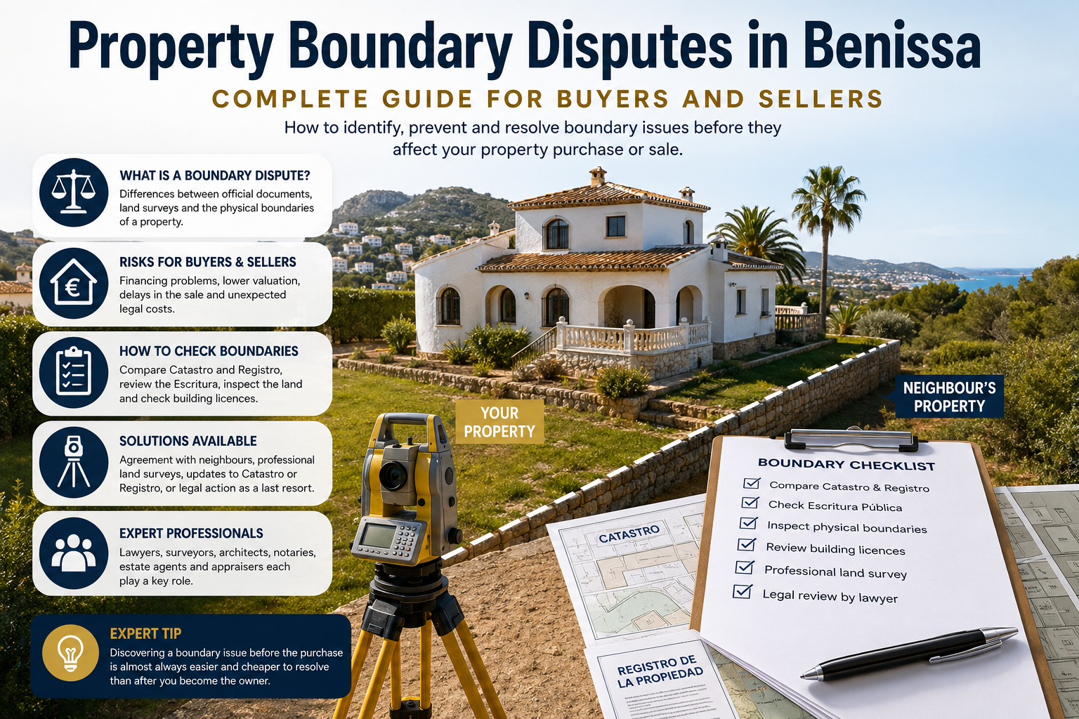
Boundary Disputes in Benissa: The Complete Guide
Boundary disputes are among the most common legal issues that can affect property transactions in Spain. Although many disputes involve only a small strip of land or the position of a fence, they can delay property sales, complicate mortgage applications, reduce a property's value and, in some cases, lead to lengthy legal proceedings.
If you are buying a villa in La Fustera, selling a finca in Benimarco, renovating a home in San Jaime, or investing in land near Pedramala, understanding exactly where your property's legal boundaries lie is essential.
Many buyers assume that an existing wall, hedge or fence marks the legal boundary of a property. In reality, physical boundaries do not always match the official records held by the Spanish authorities. It is surprisingly common for the Catastro (cadastral records), the Land Registry (Registro de la Propiedad), the title deeds (Escritura Pública) and the physical boundaries on site to show different measurements or descriptions.
These discrepancies are particularly common in older properties, rural fincas and plots that have been divided, extended or altered over many decades.
Fortunately, most boundary issues can be identified—and often resolved—before they become expensive problems. The key is understanding how Spain's property records work together and carrying out the appropriate checks before buying, selling or undertaking building work.
In this comprehensive guide, we explain:
- What boundary disputes are.
- Why they occur.
- Why they are relatively common in Benissa.
- How they affect buyers and sellers.
- How professionals investigate and resolve them.
- Practical steps to avoid future disputes.
Whether you are a homeowner, investor or first-time buyer, this guide will help you make informed decisions and reduce the risk of costly surprises.
Expert Tip
Never rely solely on fences, walls or hedges to determine ownership. Always compare the Catastro, the Land Registry and the title deeds. If any discrepancies exist, consider commissioning an independent topographical survey before proceeding.
Table of Contents
- What Is a Boundary Dispute?
- Understanding Property Boundaries in Spain
- Catastro vs Land Registry – Understanding the Differences
- Common Causes of Boundary Disputes in Benissa
- How Boundary Disputes Affect Property Buyers
- How Boundary Disputes Affect Property Sellers
- How to Check Property Boundaries Before Buying
- How Professionals Resolve Boundary Disputes
- Resolving a Boundary Dispute in Spain
- Typical Costs of Resolving a Boundary Dispute
- Real-Life Examples from Benissa
- How to Prevent Boundary Disputes
- Frequently Asked Questions
- Conclusion
What Is a Boundary Dispute?
Definition of a Boundary Dispute
A boundary dispute is a disagreement about the location of the legal boundary between neighbouring properties.
The disagreement may relate to:
- ownership of a strip of land
- boundary walls
- fences
- hedges
- retaining walls
- gardens
- swimming pools
- garages
- access routes
- agricultural land
- building encroachments
In Spain, these disputes often arise because different official records describe the property differently or because visible boundary features have changed over time without the legal documentation being updated.
Quick Answer
A boundary dispute is a disagreement over where one property ends and another begins. Determining the correct boundary in Spain often requires comparing the Catastro, the Land Registry, the title deeds and, where necessary, a professional topographical survey.
Why Boundary Disputes Occur
Contrary to popular belief, most boundary disputes do not arise because someone deliberately attempts to take another person's land.
Instead, they usually develop gradually through a combination of historical changes, inaccurate measurements and misunderstandings.
Common causes include:
- historic surveying methods
- inaccurate measurements
- replacement fences built in the wrong position
- old agricultural walls
- undocumented agreements between neighbours
- inherited land with unclear documentation
- property extensions
- swimming pools
- garden landscaping
- administrative inconsistencies
Many properties in Benissa have changed ownership several times over the past fifty years. During that time, gardens have been redesigned, walls rebuilt and plots divided without every official record being updated accordingly.
Why They Are Common in Benissa
Benissa has a particularly varied property market that combines coastal villas, traditional villages and extensive rural countryside.
This diversity increases the likelihood of boundary discrepancies.
Historic Rural Properties
Many fincas in Benimarco, Pedramala and the surrounding countryside date back many decades.
Historically, boundaries were often identified using:
- dry-stone walls
- agricultural terraces
- trees
- irrigation channels
- natural landmarks
While these methods were entirely appropriate at the time, they rarely provide the precision expected today.
Mixed Urban and Rural Development
Areas such as:
- La Fustera
- Fanadix
- Buenavista
- San Jaime
combine modern villas with older agricultural land.
As urban development has expanded, older boundaries have sometimes become more difficult to interpret.
Historic Plot Divisions
Large agricultural estates have frequently been divided into smaller plots over many years.
Although ownership may be perfectly valid, official records do not always reflect every historic subdivision with complete accuracy.
Renovations
Many buyers renovate older villas shortly after purchase.
If boundaries are not verified first, new construction may unintentionally extend onto neighbouring land.
Important
Boundary disputes are not limited to rustic properties. Modern villas, apartments with gardens and building plots can also be affected if documentation has not been updated correctly.
Understanding Property Boundaries in Spain
One of the biggest differences between buying property in Spain and many other countries is that several official records exist, each serving a different purpose.
Understanding how these records work together is essential.
Physical Boundaries (Walls, Fences and Hedges)
Physical boundaries include:
- fences
- hedges
- dry-stone walls
- retaining walls
- gates
- wire fencing
- vegetation
These are the boundaries most people see during a property viewing.
However, they should never automatically be treated as legal boundaries.
A wall may have been rebuilt decades ago.
A hedge may have gradually moved.
A fence may have been installed incorrectly.
An agricultural wall may never have represented ownership in the first place.
Common Mistake
"The wall marks the legal boundary."
This assumption causes many disputes.
The legal boundary may actually lie several metres beyond—or inside—the existing wall.
Cadastral Boundaries (Catastro)
The Catastro is Spain's official cadastral register.
Its primary purpose is taxation and public administration.
It records:
- cadastral reference
- plot shape
- approximate boundaries
- buildings
- building footprint
- land use
- surface area
The Catastro is an extremely valuable source of information, but it is not automatically definitive proof of legal ownership or precise legal boundaries.
Its mapping has improved considerably in recent years, yet some older rural properties still contain historical inaccuracies.
Land Registry Boundaries (Registro de la Propiedad)
The Land Registry protects legal ownership rights.
It typically records:
- registered owner
- legal description
- registered plot size
- mortgages
- easements
- legal restrictions
Unlike the Catastro, its purpose is legal security rather than taxation.
Registry descriptions for older properties sometimes rely on written descriptions that pre-date modern mapping.
For example:
"Bounded to the north by the old stone wall."
If that wall has disappeared, determining the exact legal boundary may require further investigation.
Property Deeds (Escritura Pública)
The Escritura Pública is the notarised purchase deed signed before a Notary.
It usually records:
- ownership
- purchase details
- legal description
- declared plot size
- buildings
Older deeds may differ slightly from both the Registry and the Catastro.
This does not necessarily indicate a legal problem, but it should prompt further investigation where significant discrepancies exist.
Boundary Markers (Mojones)
Many rural properties around Benissa still contain traditional mojones—stone boundary markers historically used to indicate the limits of agricultural land.
These markers can provide useful evidence when investigating historic boundaries, particularly where old stone walls or natural landmarks have disappeared.
However, they should always be considered alongside official documentation and, where appropriate, a professional survey.
Which Boundary Is Legally Correct?
There is no universal answer.
Professionals typically compare:
- Title deeds.
- Land Registry.
- Catastro.
- Existing physical boundaries.
- Historic documentation.
- Topographical surveys.
Where all these sources agree, ownership is usually straightforward.
Where they differ, additional investigation is advisable before purchasing, selling or building.
Warning
Never assume that visible boundaries accurately reflect legal ownership. Identifying discrepancies before completion is almost always quicker and less expensive than resolving them afterwards.
Key Takeaways
- Walls and fences do not necessarily represent legal ownership.
- The Catastro, Land Registry and title deeds each have different purposes.
- Rural properties are more likely to contain historic discrepancies.
- Professional surveys provide valuable clarity where uncertainty exists.
- Early investigation can prevent delays, neighbour disputes and unnecessary legal costs.
Catastro vs. Land Registry – Understanding the Differences
One of the most common sources of confusion for overseas buyers is discovering that two official records describe the same property differently.
This is not unusual in Spain, particularly where older villas, traditional fincas and rural plots are concerned.
Understanding the purpose of each record is essential before buying or selling property in Benissa.
Expert Tip
During conveyancing, your lawyer should compare the Catastro, the Land Registry, the title deeds and the property's physical boundaries. When all four correspond, the transaction is usually much smoother.
Purpose of the Catastro
The Catastro is Spain's national cadastral register, maintained by the Spanish Tax Administration.
Its principal purpose is administrative rather than legal.
Each property receives a unique Referencia Catastral (Cadastral Reference Number) that identifies the land and buildings for taxation and public administration.
Typical information recorded includes:
- Plot boundaries
- Approximate surface area
- Building footprint
- Property use
- Construction details (where recorded)
- Cadastral value
- Geographic location
Modern digital mapping has significantly improved the accuracy of cadastral information. Nevertheless, some older properties in Benissa still reflect historic surveys that may no longer match the physical reality on the ground.
The Catastro is an invaluable research tool, but it should not be relied upon in isolation when determining legal ownership.
Purpose of the Land Registry
The Registro de la Propiedad (Land Registry) exists to protect legal ownership and record rights affecting a property.
Unlike the Catastro, its primary purpose is legal certainty.
Registry records typically include:
- Registered ownership
- Legal description of the property
- Registered plot size
- Mortgages
- Easements
- Charges
- Restrictions affecting ownership
When purchasing property, the Land Registry plays a central role in confirming who owns the property and what legal rights are attached to it.
Why Measurements Often Differ
One of the first questions buyers ask is:
"Why do the Catastro and the Land Registry show different measurements?"
The answer is usually straightforward.
Different records have often been created, updated and maintained at different times and for different purposes.
Common reasons include:
Historic Surveying Methods
Many properties were originally measured decades ago using equipment far less accurate than today's GPS technology.
Agricultural Plot Divisions
Large rural estates have frequently been divided into smaller plots over many years.
Some official records were updated immediately, while others were amended much later—or not at all.
Extensions and Alterations
Additional buildings such as:
- garages
- swimming pools
- storage rooms
- covered terraces
may have been constructed after the original records were created.
Administrative Updates
The Catastro has undergone several nationwide mapping improvements.
Older Registry descriptions may still rely upon written descriptions created long before digital mapping existed.
Human Error
Occasionally, simple clerical mistakes made many years ago continue to appear in official records.
Most can be corrected once properly identified.
Which Records Should Buyers Trust?
The safest approach is not to rely exclusively on any single document.
Instead, buyers should compare:
- Catastro
- Land Registry
- Title deeds
- Physical inspection
- Planning documentation
- Professional survey (where necessary)
When all these sources broadly agree, the likelihood of future problems is greatly reduced.
Where significant inconsistencies exist, buyers should investigate them before signing contracts.
Warning
Even relatively small discrepancies may affect mortgage valuations, planning permissions or future resale negotiations.
Georeferencing and Why It Matters
Modern Spanish property law increasingly relies on georeferenced coordinates to improve consistency between the Catastro and the Land Registry.
Georeferencing uses precise GPS coordinates to define the position of a property's legal boundaries.
For buyers, this provides greater certainty because:
- boundaries can be measured more accurately
- neighbouring plots are less likely to overlap
- future transactions become simpler
- Registry and Catastro information can be better aligned
Although not every property has fully coordinated georeferenced records, their use continues to expand, particularly where boundaries are formally updated.
Catastro vs. Land Registry Comparison
| Feature | Catastro | Land Registry |
|---|---|---|
| Primary purpose | Tax administration | Legal ownership |
| Managed by | Spanish Tax Administration | Ministry of Justice |
| Records ownership | Administrative reference | Yes |
| Shows plot mapping | Yes | Legal description and registered information |
| Includes buildings | Yes | Yes (where registered) |
| Used for taxation | Yes | No |
| Used during conveyancing | Supporting information | Essential |
| Used by mortgage lenders | Supporting evidence | Yes |
| Can measurements differ? | Yes | Yes |
| Can records be corrected? | Yes | Yes |
Did You Know?
It is entirely possible for both the Catastro and the Land Registry to be correct within their respective purposes while still requiring professional clarification before a property transaction.
Common Causes of Boundary Disputes in Benissa
Boundary disputes occur throughout Spain, but several characteristics make them particularly common in Benissa.
The municipality combines modern coastal developments with traditional agricultural land that has evolved over many generations.
Historic Surveying Errors
Many older rural properties were measured using historic surveying methods.
Measurements based on:
- chains
- tapes
- landmarks
- agricultural references
cannot always match today's GPS accuracy.
Old Stone Walls and Rural Fincas
Traditional dry-stone walls are one of Benissa's defining landscape features.
However, many were originally built to:
- retain agricultural terraces
- separate crops
- contain livestock
rather than indicate precise legal ownership.
Assuming every old wall marks the legal boundary is one of the most common mistakes buyers make.
Local Insight
In the countryside around Benimarco and Pedramala, many stone walls pre-date the modern cadastral system by decades. Their historical significance is undeniable, but they should never replace professional boundary verification.
Incorrect Fence Placement
Replacing an ageing fence without first confirming the legal boundary is a surprisingly common cause of disputes.
Typical situations include:
- following an already incorrect fence line
- rebuilding after storm damage
- landscaping projects
- replacing hedges with fencing
Once installed, these boundaries may remain unquestioned for many years.
Neighbouring Extensions
Property improvements occasionally extend beyond the legal boundary.
Examples include:
- garages
- terraces
- pergolas
- garden rooms
- storage buildings
These issues are often discovered during mortgage valuations or legal due diligence.
Swimming Pools Built Too Close to Boundaries
Swimming pools remain one of the most desirable features in Benissa.
However, incorrectly positioned pools can create:
- planning issues
- mortgage concerns
- buyer negotiations
- legal uncertainty
This is why buyers should ensure pools correspond with approved documentation.
Garden Walls and Retaining Walls
Retaining walls are common on sloping Costa Blanca plots.
Boundary disputes may arise if:
- walls have been rebuilt
- landscaping has changed levels
- neighbouring land has been incorporated into gardens
Agricultural Land Divisions
Rustic plots have often been divided several times over successive generations.
Historic documentation may not always reflect these changes consistently.
Inheritance and Plot Subdivision
Inherited properties occasionally contain undocumented family arrangements or historic subdivisions.
These should always be investigated before a sale proceeds.
Easements Mistaken for Ownership
A frequent misunderstanding arises where buyers confuse ownership with rights of access (easements).
For example:
A neighbour may have a legal right to cross part of a property without owning that land.
Understanding this distinction is essential during due diligence.
How Boundary Disputes Affect Property Buyers
Boundary issues affect much more than ownership.
They can influence financing, future development and resale value.
Risks Before Purchasing
Buyers should establish:
- what land is actually included
- whether buildings sit within legal boundaries
- whether neighbouring structures encroach
- whether official records agree
Failure to investigate these questions can lead to significant expense after completion.
Mortgage Approval Issues
Mortgage lenders carry out their own legal and valuation checks.
Where significant discrepancies exist they may:
- request further documentation
- require an updated survey
- delay approval
- reduce lending
- postpone completion until clarification is obtained
Valuation Problems
Surveyors compare:
- legal documentation
- buildings
- plot size
- boundaries
If inconsistencies increase legal risk, the valuation may be affected accordingly.
Future Renovation Restrictions
Boundary uncertainty may complicate future plans to:
- build an extension
- install a swimming pool
- construct retaining walls
- erect fencing
- add garages
Resolving these issues before purchase is considerably easier.
Insurance Considerations
Some insurers ask whether a property is affected by ongoing legal disputes.
Where appropriate, buyers should disclose relevant information and seek professional advice regarding available cover.
Selling During an Existing Boundary Dispute
A property can often still be sold while a boundary issue is unresolved.
However:
- buyers may negotiate on price
- lenders may request clarification
- completion may be delayed
- additional legal work may be required
Where possible, resolving the issue before marketing usually results in a smoother transaction.
Expert Tip
A boundary issue discovered before exchange of contracts is usually far easier to resolve than one discovered after completion.
How Boundary Disputes Affect Property Sellers
Boundary discrepancies can undermine buyer confidence even where the issue is relatively minor.
Delays During Conveyancing
Lawyers may recommend additional investigations before allowing contracts to proceed.
Buyer Negotiations
Boundary uncertainty often results in:
- requests for surveys
- price renegotiations
- delayed completion
- additional legal enquiries
Reduced Market Value
Although not every discrepancy affects value, unresolved legal uncertainty can reduce buyer confidence and influence negotiations.
Legal Disclosure
Sellers should answer buyers' questions honestly and seek legal advice where they are aware of existing boundary issues.
Transparency generally helps maintain confidence throughout the transaction.
Warning
Attempting to minimise a known boundary issue may cause a sale to collapse if the discrepancy is later identified during legal due diligence or mortgage valuation.
How to Check Property Boundaries Before Buying
Buying a property in Benissa is one of the largest financial decisions most people will make. Carrying out thorough boundary checks before signing a reservation contract can help prevent unexpected legal costs, delays and disputes after completion.
Whether you are purchasing a modern villa in San Jaime, a coastal property in La Fustera, or a traditional finca in Pedramala, the same principle applies: verify the legal boundaries before committing to the purchase.
Expert Tip
A boundary issue identified before contracts are signed usually becomes part of the negotiation. The same issue discovered after completion becomes the buyer's responsibility to investigate and resolve.
Compare Catastro and Registry Records
One of the first tasks your lawyer should undertake is comparing the property's information held by the Catastro and the Land Registry (Registro de la Propiedad).
Check that the following correspond:
- Plot size
- Plot shape
- Property description
- Building footprint
- Registered buildings
- Cadastral reference
- Boundary configuration
Small differences are not uncommon, particularly for older properties. However, significant discrepancies should always be investigated before proceeding.
Internal Link Opportunity: Understanding the Catastro in Spain
Internal Link Opportunity: Understanding the Land Registry (Registro de la Propiedad)
Review the Property Deeds
The Escritura Pública remains one of the most important documents in any Spanish property transaction.
Your lawyer should compare the title deeds with:
- The Catastro
- The Land Registry
- Planning documentation
- Existing buildings
- Physical boundaries
Older deeds may refer to neighbouring landowners, agricultural landmarks or historic stone walls that no longer exist. Where descriptions differ from the current situation, further investigation may be required.
Commission a Topographical Survey
If there is any doubt about the boundaries, instructing a licensed topographical surveyor (topógrafo) is usually the most reliable way to establish the property's dimensions.
A professional survey can:
- Measure the plot accurately.
- Identify encroachments.
- Compare official records with the site.
- Confirm the location of buildings.
- Support future Registry or Catastro updates if required.
- Provide valuable evidence if a dispute arises.
Surveys are particularly advisable when purchasing:
- Rural fincas
- Agricultural land
- Large building plots
- Properties requiring renovation
- Homes with recent extensions
- Properties where the Catastro and Registry differ significantly
Although a survey represents an additional upfront expense, it is often insignificant compared with the potential cost of resolving a boundary dispute after purchase.
Inspect Existing Boundary Markers
During viewings, take time to inspect the property's perimeter carefully.
Look for:
- Dry-stone walls
- Boundary posts
- Mojones (traditional boundary markers)
- Wire fencing
- Hedges
- Retaining walls
- Shared driveways
- Access tracks
These features do not prove legal ownership, but they may highlight areas requiring closer investigation.
Warning Signs
Consider asking further questions if you notice:
- Two different fence lines.
- Shared access roads.
- Buildings unusually close to neighbouring plots.
- Recently replaced fencing.
- Neighbours maintaining part of the land.
- Visible differences between the site and cadastral plans.
Verify Planning Permissions
Boundary issues often come to light when comparing buildings with approved planning documentation.
Ask your lawyer to verify:
- Building licences
- Planning permissions
- Completion certificates (where applicable)
- Occupancy documentation
- Whether buildings appear correctly on official records
This is particularly important if the property has:
- Swimming pools
- Garages
- Guest accommodation
- Covered terraces
- Outbuildings
- Retaining walls
Internal Link Opportunity: Building Legality in Benissa
Internal Link Opportunity: Pool Legalisation in Benissa
Speak with Neighbours (Where Appropriate)
This is not always necessary, but for rural properties it can sometimes provide useful background.
Neighbours may know:
- Historic boundary changes.
- Previous agreements.
- Shared access arrangements.
- Agricultural use.
- Earlier surveys.
Informal conversations should never replace professional legal advice, but they can sometimes highlight issues worth investigating further.
Consult Your Lawyer
An experienced independent property lawyer remains your most important adviser throughout the transaction.
They should:
- Compare official records.
- Identify inconsistencies.
- Recommend additional surveys where appropriate.
- Review planning documentation.
- Explain legal risks.
- Coordinate with surveyors and architects where necessary.
Important
Estate agents can identify potential warning signs, but only an independent lawyer can advise you on the legal implications of boundary discrepancies.
Buyer Boundary Verification Checklist
Documentation
- □ Obtain a recent Nota Simple.
- □ Compare the Catastro and Land Registry.
- □ Review the title deeds.
- □ Verify the cadastral reference.
- □ Compare plot measurements.
Physical Inspection
- □ Walk the full perimeter.
- □ Photograph walls and fences.
- □ Check retaining walls.
- □ Identify shared access.
- □ Look for mojones.
- □ Compare the site with cadastral plans.
Professional Advice
- □ Instruct an independent lawyer.
- □ Commission a survey if necessary.
- □ Verify planning permissions.
- □ Confirm all buildings are documented.
- □ Resolve discrepancies before signing contracts.
Common Mistake
Buyers often assume that because a property has existed for many years, its boundaries must be correct. In reality, many discrepancies remain unnoticed until a sale or mortgage valuation brings them to light.
How Professionals Resolve Boundary Disputes
Boundary disputes are rarely resolved by one professional acting alone.
Instead, surveyors, architects, lawyers, notaries and public authorities each play a different role depending on the nature of the issue.
Licensed Surveyors
A licensed topographical surveyor is usually the first specialist instructed where boundaries are uncertain.
They use modern equipment to:
- Measure land accurately.
- Produce detailed plans.
- Locate buildings.
- Compare the site with official records.
- Identify encroachments.
- Prepare technical reports.
These reports frequently form the basis for negotiations between neighbours.
Architects
Architects become particularly important when buildings are involved.
Typical examples include:
- Swimming pools
- Extensions
- Garages
- Garden walls
- Retaining walls
- New construction
They assess whether structures correspond with approved planning documentation and can prepare technical reports where required.
Property Lawyers
Lawyers coordinate the legal aspects of resolving the dispute.
Their responsibilities include:
- Reviewing title deeds.
- Comparing Registry and Catastro records.
- Advising clients on legal rights.
- Negotiating with neighbouring owners.
- Preparing agreements.
- Managing Registry or cadastral updates.
Many disputes are resolved without court proceedings.
Notaries
A Notary does not decide where a legal boundary lies.
Instead, they authenticate legal documents and formalise agreements reached between the parties.
Where neighbours agree to amend ownership documentation, the Notary may play an important role in recording that agreement.
The Ayuntamiento's Role
The Ayuntamiento de Benissa may become involved where the issue relates to:
- Planning permissions
- Building licences
- Urban planning
- Municipal regulations
However, disputes over ownership between neighbouring properties are generally private legal matters.
Court Proceedings as a Last Resort
Most professionals aim to resolve disputes without litigation.
Where agreement cannot be reached, the courts may consider:
- Survey reports
- Registry records
- Catastro information
- Title deeds
- Historic documentation
- Expert evidence
- Witness testimony where relevant
Judicial proceedings are typically slower, more expensive and less predictable than negotiated solutions.
Who Does What During a Boundary Dispute?
| Professional | Primary Role | Typical Stage |
|---|---|---|
| Licensed Surveyor | Measures boundaries and prepares technical survey | Early investigation |
| Architect | Reviews buildings and planning compliance | Where structures are involved |
| Property Lawyer | Reviews legal documentation and negotiates | Throughout the process |
| Notary | Formalises agreements and deeds | After agreement is reached |
| Ayuntamiento | Planning and licensing matters | Where municipal issues arise |
| Court | Determines unresolved legal disputes | Last resort |
Typical Timeline
Every dispute is unique, but the following provides a general indication of how long each stage may take.
| Stage | Typical Timeframe* |
|---|---|
| Initial legal review | A few days to 2 weeks |
| Topographical survey | 1–3 weeks |
| Survey report | 1–2 weeks |
| Negotiation between neighbours | Several weeks to a few months |
| Registry or Catastro amendments | Varies depending on complexity |
| Court proceedings | Can extend over many months or longer |
*These timeframes are indicative only and vary depending on the complexity of the case, the availability of documentation, the cooperation of the parties involved and the relevant authorities.
Did You Know?
Many boundary discrepancies are discovered and resolved during the conveyancing process, allowing buyers and sellers to complete the transaction without the need for court proceedings.
Key Takeaways
- Compare the Catastro, Land Registry and title deeds before purchasing.
- Commission a survey whenever boundaries are uncertain.
- Surveyors establish the facts; lawyers advise on the legal implications.
- Architects become important where buildings or planning permissions are involved.
- Most disputes can be resolved through professional advice and cooperation without litigation.
Resolving a Boundary Dispute in Spain
Discovering a boundary discrepancy does not automatically mean a lengthy legal dispute is inevitable. In many cases, issues can be resolved through open communication, professional surveys and updates to official records without the need for court proceedings.
The appropriate solution depends on the nature of the problem. A simple administrative error on the Catastro requires a different approach from a disagreement over the ownership of land between neighbouring properties.
The earlier the issue is identified, the easier—and often less expensive—it is to resolve.
Expert Tip
If a boundary discrepancy is discovered during the buying or selling process, resolving it before completion will usually increase buyer confidence and reduce the likelihood of delays during conveyancing.
Informal Agreement Between Neighbours
Many boundary disputes begin with a misunderstanding rather than a deliberate attempt to claim land.
For example, neighbours may both believe that an existing wall marks the legal boundary because it has remained unchanged for many years.
The first step is often to:
- Compare official documentation.
- Review historical records.
- Walk the boundary together.
- Discuss the issue openly.
- Agree to appoint an independent surveyor if required.
Where both parties accept the evidence, the matter can often be resolved amicably.
Negotiated agreements are usually quicker, less costly and preserve good neighbourly relations.
Boundary Surveys
Where documents alone cannot establish the correct boundary, a professional topographical survey is normally the next step.
Modern surveying equipment allows extremely accurate measurements using GPS and other advanced techniques.
A survey may identify:
- Incorrect fence positions.
- Buildings crossing boundaries.
- Plot measurement discrepancies.
- Historic walls.
- Encroachments.
- Shared access routes.
Although a survey does not determine ownership by itself, it provides objective technical evidence that lawyers, Registry officials and courts may rely upon.
Correcting the Catastro
If the discrepancy results from inaccurate cadastral information, it may be possible to request an amendment.
Examples include:
- Incorrect plot measurements.
- Missing buildings.
- Incorrect building footprints.
- Updated boundary information supported by appropriate evidence.
The procedure depends on the specific circumstances and supporting documentation.
Professional advice should always be obtained before requesting changes to official records.
Important
Updating the Catastro does not automatically update the Land Registry. Although both records increasingly work together, each has its own procedures and legal purpose.
Updating the Land Registry
Where ownership information or legal descriptions require amendment, changes to the Land Registry may also be necessary.
Depending on the circumstances, this may involve:
- Survey documentation.
- Notarial deeds.
- Agreements between neighbouring owners.
- Supporting legal evidence.
Your lawyer will advise on the most appropriate procedure for your particular situation.
Maintaining accurate Registry records can make future sales, inheritances and mortgage applications significantly easier.
Judicial Resolution
Court proceedings should generally be viewed as the final option.
Litigation may become necessary where:
- Neighbours cannot reach agreement.
- Ownership is genuinely disputed.
- Documentary evidence conflicts.
- Significant financial interests are involved.
The court may consider:
- Topographical surveys.
- Registry documentation.
- Catastro records.
- Title deeds.
- Historical evidence.
- Expert testimony.
- Witness statements where relevant.
Because court proceedings can be lengthy and expensive, professionals usually encourage negotiation wherever possible.
Warning
Every boundary dispute is unique. The outcome depends on the specific facts, evidence and applicable law. Property owners should always obtain independent legal advice before commencing legal proceedings.
Typical Boundary Dispute Resolution Process
Boundary discrepancy discovered
            │
            ▼
Compare Catastro, Registry and Title Deeds
            │
            ▼
Inspect the property boundaries
            │
            ▼
Commission a topographical survey
            │
            ▼
Lawyer reviews all evidence
            │
    ┌───────┴────────┐
    ▼                ▼
Agreement reached?   No agreement
    │                │
    ▼                ▼
Registry/Catastro    Court proceedings
updated if required  (last resort)
    │                │
    └────────┬───────┘
             ▼
Boundary issue resolved
Typical Costs of Resolving a Boundary Dispute
The cost of resolving a boundary dispute varies depending on the complexity of the issue, the professionals involved and whether court proceedings become necessary.
The figures below are intended as general guidance only.
| Service | Typical Cost* | When Required |
|---|---|---|
| Topographical survey | €500–€1,500+ | Confirming property boundaries |
| Architect's report | €500–€2,000+ | Where buildings or planning issues are involved |
| Property lawyer | Varies according to complexity | Legal advice and negotiations |
| Catastro amendment | Administrative fees plus professional costs where applicable | Correcting cadastral information |
| Land Registry amendment | Registry fees plus professional costs | Updating legal records |
| Notary fees | Vary according to the legal act | Recording agreements or deeds |
| Court proceedings | Highly variable | Only where negotiation fails |
*Indicative figures only. Costs vary depending on the size of the property, the complexity of the dispute, the professionals appointed and any official fees that may apply.
Expert Tip
Commissioning a survey before purchasing a property often costs only a fraction of the legal expenses that can arise if a dispute is discovered after completion.
Real-Life Examples from Benissa
The following examples are based on situations commonly encountered in the Benissa property market. They are illustrative only and do not describe actual clients or transactions.
Example 1 – Swimming Pool Close to a Neighbouring Boundary
A British couple agree to purchase a villa in La Fustera.
During the legal due diligence process, the survey reveals that the swimming pool has been constructed closer to the boundary than indicated on the approved plans.
Outcome
Completion is postponed while the documentation is reviewed and the position clarified, avoiding future legal uncertainty.
Example 2 – Catastro Shows a Smaller Plot Than the Title Deeds
A Dutch buyer is purchasing a traditional finca in Benimarco.
The title deeds record a larger plot than the Catastro.
A topographical survey confirms the physical measurements and enables the parties to investigate the discrepancy before contracts are exchanged.
Outcome
The buyer proceeds with greater confidence after obtaining clarification from the legal advisers.
Example 3 – Historic Stone Wall Does Not Match the Legal Boundary
Two neighbouring owners in Pedramala both assume an old dry-stone wall marks the property boundary.
A modern survey demonstrates that the legal boundary lies beyond the existing wall.
Outcome
The neighbours agree to formalise the correct boundary without court proceedings.
Example 4 – Fence Installed Inside the Legal Plot
Owners of neighbouring villas in San Jaime disagree about the position of a recently installed fence.
A survey confirms that the fence has been erected inside one owner's legal plot.
Outcome
The fence is relocated by agreement, preserving good neighbourly relations and avoiding unnecessary legal costs.
Example 5 – Mortgage Valuation Identifies a Boundary Discrepancy
A buyer applies for a mortgage on a villa in Buenavista.
During the valuation, the surveyor notices inconsistencies between the property's documentation and the physical boundaries.
The lender requests clarification before issuing the final mortgage offer.
Outcome
The discrepancy is investigated and resolved before completion, allowing the purchase to proceed with confidence.
Common Mistakes That Lead to Boundary Disputes
Many disputes could be avoided through better preparation.
The most common mistakes include:
- Assuming a fence marks the legal boundary.
- Buying without comparing the Catastro and Land Registry.
- Renovating before confirming property boundaries.
- Building a swimming pool too close to a neighbouring plot.
- Constructing retaining walls without accurate measurements.
- Replacing boundary fencing without a survey.
- Ignoring discrepancies because they have "always been there".
- Failing to update official records after agreed changes.
Warning
A boundary issue that appears insignificant today may become a major obstacle when selling the property or applying for a mortgage in the future.
When Should You Commission a Survey?
Not every purchase requires a topographical survey.
However, one is strongly recommended if:
- You are buying a rural finca.
- The plot is unusually large.
- Boundaries are unclear.
- The property includes agricultural land.
- There are retaining walls or terraces.
- Buildings have recently been extended.
- The Catastro and Registry differ significantly.
- You intend to build or renovate.
- Neighbours have previously questioned the boundary.
For many buyers, the reassurance provided by a professional survey outweighs the relatively modest additional cost.
Key Takeaways
- Most boundary disputes can be resolved without court proceedings.
- Independent surveys often provide the evidence needed to clarify ownership.
- Administrative corrections may resolve discrepancies in official records.
- Legal advice should always be obtained before updating property documentation.
- Resolving issues before buying or selling usually saves considerable time and expense.
How to Prevent Boundary Disputes
Although not every disagreement can be avoided, many boundary disputes arise because buyers, sellers or neighbours make assumptions instead of verifying the facts. A small investment in due diligence before buying, selling or carrying out building work can prevent months of stress, unnecessary expense and delays.
Whether you own a villa in La Fustera, a traditional finca in Benimarco, a property in San Jaime, or land in the countryside around Pedramala, taking a proactive approach is the best way to protect your investment.
Expert Tip
If there is any uncertainty about a property's boundaries, resolve it before marketing the property or starting building work. Buyers, lenders and insurers all prefer properties with clear and consistent documentation.
For Buyers
Before committing to purchase a property:
- Compare the Catastro with the Land Registry.
- Review the title deeds carefully.
- Walk the entire boundary.
- Check that walls and fences correspond with official plans where possible.
- Ask whether any previous disputes have existed.
- Commission a topographical survey if there is any uncertainty.
- Ensure your lawyer investigates discrepancies before contracts are signed.
Buyers intending to renovate, extend or build a swimming pool should be particularly cautious, as uncertainty over boundaries may affect planning permissions and future works.
Internal Link Opportunity: Property Checks Before Buying in Benissa
For Sellers
Preparing documentation before placing your property on the market can reduce delays during conveyancing.
Before marketing your property:
- Review the Catastro.
- Review the Land Registry.
- Check that plot measurements are consistent.
- Confirm that all buildings are properly documented.
- Locate any historic surveys.
- Inform your lawyer of any previous boundary issues.
- Resolve discrepancies where practical.
Transparency helps build buyer confidence and often reduces last-minute negotiations.
Internal Link Opportunity: Required Documents When Selling Property in Benissa
Before Renovating
Many disputes begin after renovation work.
Before carrying out alterations:
- Confirm the legal boundary.
- Review planning requirements.
- Speak with neighbours where work will affect shared boundaries.
- Obtain professional advice for major works.
- Keep copies of surveys and approved plans.
This is particularly important for older properties where historic boundaries may not be obvious.
Before Building a Swimming Pool
Swimming pools are one of the most popular improvements in Benissa, but incorrect positioning can create significant legal and planning complications.
Before construction:
- Confirm the legal boundary.
- Check applicable planning requirements.
- Ensure the design matches approved plans.
- Retain all supporting documentation.
Internal Link Opportunity: Swimming Pools in Benissa
Internal Link Opportunity: Pool Legalisation Guide
Before Constructing Walls or Fences
Replacing an old fence appears straightforward, but moving it even a short distance without confirming the legal boundary can create long-term disputes.
Before beginning work:
- Verify the legal boundary.
- Discuss proposals with neighbours where appropriate.
- Avoid relying solely on existing fencing.
- Commission a survey if uncertainty exists.
Boundary Dispute Prevention Checklist
Before Buying
- □ Compare the Catastro and Land Registry.
- □ Review the title deeds.
- □ Walk the full perimeter.
- □ Ask about previous disputes.
- □ Commission a survey if appropriate.
- □ Instruct an independent property lawyer.
Before Selling
- □ Check official property records.
- □ Confirm plot measurements.
- □ Resolve known discrepancies where possible.
- □ Gather all supporting documentation.
- □ Inform your lawyer about previous issues.
Before Building
- □ Confirm the legal boundary.
- □ Verify planning requirements.
- □ Check approved plans.
- □ Keep copies of surveys.
- □ Obtain professional advice where necessary.
Common Mistake
Waiting until the buyer's lawyer or mortgage surveyor discovers a boundary issue often results in delays, additional legal costs and unnecessary renegotiations.
Frequently Asked Questions
What is a boundary dispute?
A boundary dispute is a disagreement about where one property ends and another begins. It may involve fences, walls, gardens, buildings, driveways or strips of land.
Is the Catastro legally binding?
The Catastro is an official administrative record used primarily for taxation and property identification. It is an important source of information but is not, by itself, definitive proof of legal ownership or the precise legal boundary.
What happens if the boundary is incorrect?
The solution depends on the nature of the discrepancy. It may involve a professional survey, updating official records, an agreement between neighbours or, in more complex cases, legal proceedings.
Can I buy a property with a boundary dispute?
Yes, but you should fully understand the issue before proceeding. Your lawyer can explain the risks and advise whether the matter should be resolved before completion.
How much does a topographical survey cost?
The cost depends on the size and complexity of the property. A licensed surveyor can provide a quotation based on the specific circumstances.
Can neighbours claim my land?
Every situation depends on its individual facts and the available evidence. If ownership is disputed, independent legal advice should be obtained as early as possible.
Can I move a boundary fence?
Not without first confirming the legal boundary. Moving a fence based solely on assumptions may create or worsen a dispute.
How long does it take to resolve a boundary dispute?
Straightforward matters resolved through agreement may take only a short period. More complex disputes involving official record corrections or court proceedings can take considerably longer.
Can a mortgage be refused because of a boundary dispute?
Mortgage lenders may request additional investigations if significant discrepancies exist. Whether finance is affected depends on the nature of the issue and the lender's requirements.
Do I need a lawyer?
An independent property lawyer is strongly recommended when buying or selling property in Spain. They can review the documentation, identify legal risks and advise on the appropriate course of action.
Who pays to resolve a boundary dispute?
There is no single answer. Responsibility depends on the circumstances, any agreement reached between the parties and, where relevant, the outcome of legal proceedings.
Can boundary records be corrected?
Yes. Depending on the circumstances, it may be possible to update the Catastro, the Land Registry or both using the appropriate legal procedures.
Are rural fincas more likely to have boundary disputes?
They can be. Older rural properties often have historic documentation, traditional stone walls and previous agricultural subdivisions that require additional investigation.
Does title insurance cover boundary issues?
Insurance policies differ considerably. Buyers should discuss the scope of any cover with their insurer or legal adviser before relying on it.
Can a boundary dispute delay completion?
Yes. Buyers, lawyers and mortgage lenders may require additional investigations before the transaction can proceed.
What is a mojón?
A mojón is a traditional stone or concrete marker historically used to indicate the boundary between adjoining plots, particularly on rural land. While it may provide useful evidence, it should always be considered alongside official property records.
Should I commission a survey before paying a reservation deposit?
If there are obvious concerns about boundaries or the property is a large rural finca, discussing the timing of a survey with your lawyer before committing financially may be sensible.
Are boundary disputes common in Benissa?
They are not everyday occurrences, but they are encountered more frequently in older rural properties, traditional fincas and plots that have been divided or altered over many years.
Conclusion
Boundary disputes can affect any type of property, from modern villas on the Benissa coast to traditional fincas in the surrounding countryside. While they are often associated with rural land, discrepancies can also arise in established residential developments where walls, fences or buildings do not correspond with official records.
The most important lesson is simple: never rely solely on visible boundaries to determine ownership.
Before buying or selling a property, always compare the Catastro, the Land Registry and the title deeds. If any uncertainty exists, seek advice from an independent property lawyer and consider instructing a licensed topographical surveyor.
Taking these steps early can help you:
- Avoid costly legal disputes.
- Prevent delays during conveyancing.
- Improve buyer confidence.
- Reduce the risk of mortgage complications.
- Protect the long-term value of your property.
Property legislation, administrative procedures and registration requirements may change over time. Whenever legal or technical questions arise, seek advice from appropriately qualified professionals who can assess your individual circumstances.
Buying or Selling Property in Benissa?
At Telio Homes, we specialise exclusively in property in Benissa and the surrounding areas of the Costa Blanca North.
Because we work in the local market every day, we understand the practical issues that can arise during a property transaction, including boundary discrepancies, documentation checks and legal due diligence.
If you are considering buying or selling a property and would like guidance before committing to the next step, our team can help you understand the process, coordinate with experienced local professionals and make informed decisions with confidence.
Whether you are purchasing your dream home, selling a family villa or investing in a traditional finca, obtaining the right advice at the right time can help ensure a smoother and more secure transaction.