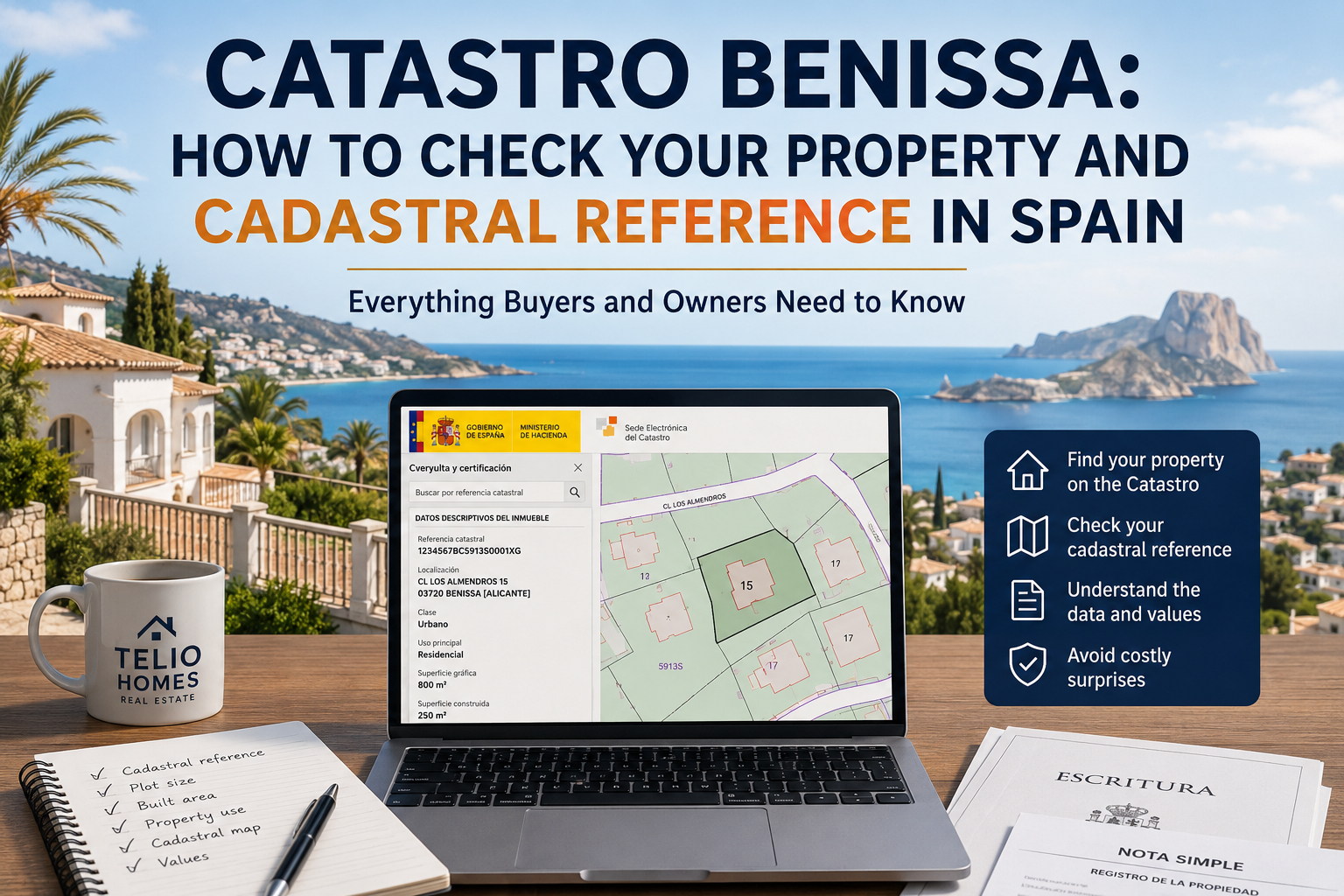
Catastro Benissa: How to Check Your Property and Cadastral Reference in Spain
Introduction
If you own, are buying or are considering selling property in Benissa, checking the Catastro Benissa record should be one of the first steps in understanding the property.
The Spanish Catastro Inmobiliario is the country's official administrative cadastral database. It records information including a property's location, cadastral reference, surface area, use, cadastral mapping and certain property values. The cadastral reference (referencia catastral) is the unique 20-character identifier used to identify a property within the cadastral system.
But there is an important distinction:
The Catastro is not the same as the Registro de la Propiedad, and the Catastro alone does not establish that every building, extension or pool on a property is legally authorised.
This matters particularly in Benissa, where the property market includes coastal villas, established urbanisations and substantial areas of rural land. A property in Benissa Costa, La Fustera, San Jaime, Fanadix, Buenavista, Benimarco or Pedramala can have documentation that has developed over many years, and the information held by different authorities does not always correspond perfectly.
For example, you may discover:
-
a house that is physically larger than the area recorded in Catastro;
-
a swimming pool that is not represented in the cadastral information;
-
several cadastral references associated with one finca;
-
a difference between the plot area in the escritura and Catastro;
-
an extension recorded in one document but not another;
-
a cadastral map that does not appear to correspond precisely with physical boundaries;
-
or a property that is not graphically coordinated between the Catastro and Registro.
None of these situations automatically means that a property is illegal. Equally, none should simply be ignored.
This guide explains how to check Catastro Benissa, how to find a cadastral reference in Spain, how Catastro differs from the Registro de la Propiedad, what cadastral discrepancies can mean, how graphical coordination works, and why additional checks are particularly important when buying a finca or rural property in the Benissa area.
Legal and tax note: Cadastral, planning and tax rules can change. This guide is intended as practical property information, not legal or tax advice. Where a discrepancy could affect a purchase, sale, ownership, planning status or tax liability, obtain advice from the appropriate qualified professional.
Table of Contents
What Is the Catastro in Spain?
The Catastro Inmobiliario is Spain's official administrative property database. It contains information about land and buildings and is maintained by the Dirección General del Catastro, under Spain's Ministry of Finance.
Spanish cadastral legislation provides for information including a property's location, cadastral reference, surface area, use or purpose, cultivation or land-use classification where applicable, construction characteristics, graphical representation, cadastral value, reference value and cadastral holder.
For property owners and buyers, the Catastro is therefore an important source of information about how a property is represented administratively and geographically.
Official Spanish Catastro Portal
What information does the Catastro contain?
Depending on the property and your access rights, cadastral information can include:
-
cadastral reference;
-
location;
-
cadastral parcel;
-
land area;
-
constructed area;
-
property use;
-
cadastral classification;
-
cadastral mapping;
-
construction characteristics;
-
cadastral value;
-
reference value;
-
cadastral holder information.
Not every item is publicly accessible.
Certain information is protected, including personal information relating to cadastral holders and cadastral value. Owners can access protected information concerning their own property through the appropriate Catastro services.
What is a cadastral reference (referencia catastral)?
A cadastral reference is the property's official 20-character alphanumeric identifier.
It is designed to identify the property unambiguously within the official cadastral system and is widely used in Spanish property and tax documentation.
You may find the reference on documents such as:
-
an IBI bill;
-
a Certificación Catastral Descriptiva y Gráfica;
-
a escritura;
-
certain Registry documentation;
-
property tax correspondence.
The precise location varies between documents.
Why is the cadastral reference important?
The reference provides a common identifier when dealing with a particular property.
It can be useful when:
-
buying or selling property;
-
checking a property on the Catastro website;
-
preparing a compraventa;
-
dealing with a notary;
-
checking property documentation;
-
dealing with tax matters;
-
identifying a parcel on cadastral mapping;
-
comparing documents relating to the same property.
For an international buyer, it is often one of the simplest ways to make sure that the Catastro search you are carrying out relates to the correct property.
Where can I find my cadastral reference?
If you are trying to locate your cadastral reference in Spain, check the following documents first:
| Document | What to look for |
|---|---|
| IBI receipt | Referencia catastral |
| Escritura | Cadastral reference associated with the property |
| Catastro certificate | Referencia catastral |
| Nota Simple | Cadastral reference where included |
| Catastro online search | Reference displayed with the cadastral property |
| Property tax correspondence | Often identifies the property by its cadastral reference |
If you are buying, ask the seller or agent for the reference and then independently compare it with the property you are viewing.
Is the Catastro proof of property ownership?
No — although the cadastral holder is not irrelevant.
The Catastro records a titular catastral, and Spanish cadastral legislation recognises certain ownership and real rights for cadastral purposes. However, the law expressly preserves the functions and legal effects of the Registro de la Propiedad. Where there is a discrepancy in registered ownership for a property identified in the Registry by its cadastral reference, the registered title can prevail for cadastral purposes subject to the statutory rules.
For a purchase in Benissa, the Catastro should therefore be treated as one part of a wider due-diligence process.
Expert Tip: If you are buying a property, compare the Catastro with the escritura, Nota Simple, physical property and, where relevant, planning documentation. No single document tells the complete story.
How to Find a Property on the Catastro in Benissa
The easiest way to investigate Catastro Benissa information is through the official Electronic Headquarters of the Catastro.
Search the Spanish Catastro and cadastral map
The service allows you to search for property information and view cadastral cartography.
How to search by property address
If you do not know the cadastral reference, you can start with the property's location.
The exact search information available will depend on how the property is recorded. This matters in Benissa because properties can be identified by:
-
street names;
-
urbanisation names;
-
road names;
-
partida names;
-
rural addresses;
-
local place names;
-
combinations of these.
A rural property in Pedramala, for example, may be easier to identify on the cadastral map than through a conventional postal address.
Practical approach
-
Open the official Catastro property search.
-
Select the relevant province and municipality.
-
Enter the available address information.
-
Review the search results carefully.
-
Select the property that appears to correspond to the physical location.
-
Check the cadastral map.
-
Compare the result with the property's documentation and physical position.
Do not assume that the first search result is automatically the correct property.
How to search using the cadastral reference
If you already have the property's 20-character cadastral reference, the process is generally much easier.
Enter the reference into the official Catastro search and check that the resulting property corresponds with:
-
the address;
-
the parcel;
-
the physical property;
-
the documentation supplied by the seller.
This is especially useful when the seller provides the reference from an IBI receipt or escritura.
How to use the cadastral map
The cadastral map becomes particularly valuable with rural properties.
You can use it to investigate:
-
the apparent position of the parcel;
-
neighbouring parcels;
-
parcel configuration;
-
cadastral boundaries;
-
buildings represented in the cadastral system;
-
relationships between adjoining cadastral parcels.
Spanish cadastral law establishes the Catastro's parcel cartography as the basis for cadastral georeferencing.
But a cadastral boundary is not automatically the final legal boundary
This distinction is critical.
A line shown on the cadastral map should not automatically be treated as conclusive proof of private ownership or the legally enforceable boundary between properties.
If a boundary is important to a transaction, the buyer may need to examine the title documents, Registry information and, where necessary, professional surveying or georeferencing.
What does "graphically coordinated with Catastro" mean?
You may encounter the phrase:
"finca coordinada gráficamente con el Catastro"
in Registry documentation.
Graphical coordination is part of the legal system connecting the Registro de la Propiedad with cadastral georeferenced information. The purpose is to provide greater security concerning the location, boundaries and surface area of registered properties involved in property transactions.
In practical terms, it means that the registered property's georeferenced graphical representation has been incorporated and coordinated with the corresponding cadastral parcel under the applicable legal procedure.
A property can also be described as not graphically coordinated.
That does not automatically mean that the owner has no title or that the property is defective. It means the cadastral and registered graphical information has not achieved the relevant state of coordination.
This distinction is particularly important when dealing with large rural properties or boundary discrepancies.
What information can you view online?
The official Catastro portal provides access to cadastral information and mapping, but access to protected information is restricted.
Depending on the property and access rights, you may be able to see information such as:
-
cadastral reference;
-
location;
-
parcel;
-
surface area;
-
cadastral use;
-
graphical representation;
-
construction information;
-
other non-protected cadastral data.
Step-by-step Catastro search guide
For the published version of this article, Telio Homes should use an annotated visual showing:
Address or reference → Search result → Correct parcel → Cadastral map → Property information → Compare with documents
Screenshots should be taken from the current official Catastro interface and updated whenever the interface changes.
What Information Can You Find in the Catastro?
Cadastral reference
The referencia catastral is the property's official cadastral identifier.
It is one of the most useful pieces of information to obtain before investigating a property because it gives you a consistent identifier for the cadastral search.
Plot or land area
The cadastral record can contain the area associated with a parcel.
For rural property, compare this carefully with the area shown in the escritura, Registry information and, where relevant, a professional survey.
A difference does not automatically establish that one document is wrong. It does mean that the discrepancy should be understood.
Built area
The Catastro can contain information about constructed areas.
This is particularly useful when buying a villa or finca.
For example:
Escritura: 150 m²
Catastro: 150 m²
Physical property: approximately 195 m²
The extra 45 m² should not simply be ignored.
The important question is:
Why is the property physically larger, and what is the legal and documentary status of the additional construction?
That may require separate planning, technical and legal checks.
Property use and classification
The cadastral record includes information about the use or purpose of property and, where relevant, the class of cultivation or land use.
This can help you understand how land is represented administratively.
However, cadastral classification should not be confused with planning permission or a town-planning certificate.
Cadastral mapping and parcel boundaries
The cadastral map provides graphical information about parcels.
This is especially useful in rural Benissa, where one property may involve several adjoining cadastral parcels.
It can reveal questions that deserve further investigation before a purchase.
Cadastral value
The cadastral value (valor catastral) is an administrative value calculated using cadastral valuation rules.
It is not a property's market price.
Factors used in cadastral valuation include legally defined characteristics of the land and construction, including location, use, quality and age.
Reference value
The reference value (valor de referencia) is a separate cadastral concept.
The Dirección General del Catastro determines it annually using its statutory methodology and information derived from property transactions and cadastral characteristics. It is a characteristic of the cadastral description and is not the same as cadastral value.
For 2026, the Catastro has published the applicable reference-value framework and provides an online consultation service.
Catastro vs Registro de la Propiedad: What Is the Difference?
For anyone buying property in Benissa, this distinction is fundamental.
| Issue | Catastro | Registro de la Propiedad |
|---|---|---|
| Main purpose | Administrative and cadastral description | Registration of ownership and other real rights |
| Cadastral reference | Yes | Included where applicable |
| Cadastral mapping | Yes | May incorporate registered georeferencing |
| Cadastral value | Yes | No |
| Reference value | Yes | No |
| Registered ownership | Not the definitive source | Yes |
| Mortgages and registered charges | Not the primary source | Yes |
| Physical description | Yes | Yes, according to registered title |
| Graphical coordination | Provides cadastral basis | Records coordination status |
| Planning legality | Not conclusive | Not conclusive on its own |
| Best use in due diligence | Cadastral identification and description | Ownership, rights and registered charges |
What does the Catastro tell you?
The Catastro helps establish how the property is represented administratively and geographically.
It is particularly useful for:
-
identifying parcels;
-
checking cadastral references;
-
reviewing cadastral areas;
-
examining cadastral mapping;
-
checking cadastral characteristics;
-
understanding cadastral and reference values.
What does the Registro de la Propiedad tell you?
The Registro deals with registered property rights.
A Nota Simple can provide information about:
-
the registered property;
-
registered owner or owners;
-
mortgages;
-
usufructs;
-
other registered rights;
-
limitations and restrictions.
The official Registrars' service states that a Nota Simple is informative and identifies the registered property, rights holders and relevant limitations. A Registry certification is a different document and has public-document status.
Which one proves ownership?
For registered ownership rights, the Registro de la Propiedad is the key source.
The Catastro itself states that its functions and information operate without prejudice to the legal effects of Registry registration. Spanish cadastral legislation also provides that, for cadastral purposes, the Registry's legal pronouncements prevail in the circumstances established by law.
Why buyers should check both
A robust property due-diligence process should normally compare:
Catastro + Registro + escritura + physical property + planning documentation
Depending on the property, it may also include:
-
licences;
-
certificates;
-
technical reports;
-
utility documentation;
-
boundary information;
-
community documentation;
-
tax information.
Warning: Finding a building in Catastro does not automatically establish that it has planning permission. Conversely, the absence of a building or pool from Catastro does not automatically prove that it is illegal.
Why Catastro Information May Not Match Your Property
Differences between Catastro and the physical property are not necessarily unusual.
The important question is what is different, why it is different and whether it affects the transaction.
The built area is different
Perhaps the original property was 120 m² and a later extension increased the physical constructed area.
Possible explanations include:
-
an extension not incorporated into Catastro;
-
historical information that was not updated;
-
differences in measurement or classification;
-
changes in the way construction has been recorded;
-
a construction issue requiring separate investigation.
Do not automatically conclude that the additional area is illegal.
Instead, establish its documentary and planning status.
The plot size is different
A finca may show different areas in:
-
Catastro;
-
escritura;
-
Registro;
-
survey documentation.
This can be particularly important in rural Benissa.
A material difference should be investigated before a buyer becomes committed to the transaction.
An extension is missing
Consider:
Escritura: 150 m²
Catastro: 150 m²
Physical property: 195 m²
The correct response is to investigate:
-
when the extension was built;
-
whether it appears in the escritura;
-
what the Registry records;
-
whether planning documentation exists;
-
whether the cadastral record requires updating;
-
whether the extension affects other property documentation.
A swimming pool is not shown
A swimming pool may be physically present but absent from or differently represented in the cadastral record.
Its absence does not automatically prove that the pool is illegal.
Before buying or selling, however, establish:
-
whether the pool is documented;
-
whether the applicable planning requirements were met;
-
whether relevant licences or permits exist where required;
-
whether the cadastral information needs updating.
See our related guide on [Pool Legalisation].
An outbuilding or other construction is missing
The same principle applies to:
-
garages;
-
storage buildings;
-
agricultural buildings;
-
terraces;
-
covered structures;
-
guest accommodation;
-
other constructions.
The existence of a structure, its cadastral representation and its planning status are separate questions.
The property has multiple cadastral references
This is particularly important with rural property.
A finca may comprise several cadastral parcels.
That is not automatically a problem.
But establish:
-
which parcels form part of the purchase;
-
whether every parcel belongs to the seller;
-
whether the escritura covers all of them;
-
whether the Registry information corresponds;
-
whether the physical property occupies the same land;
-
whether any parcel has a different classification or legal status.
The cadastral information has not been updated
Cadastral information can be incorporated or changed through several statutory procedures, including declarations, communications and applications. Notaries, Registrars and certain public administrations can also communicate information to Catastro in circumstances provided by law.
An old cadastral record therefore does not necessarily tell the complete history of a property.
Common Catastro discrepancies
| Discrepancy | Possible explanation | Recommended check |
|---|---|---|
| House larger than Catastro | Extension or outdated information | Planning, technical and property documentation |
| Pool missing | Cadastral information not updated | Pool documentation and planning status |
| Plot area differs | Measurement or historical parcel changes | Escritura, Registry and survey |
| Outbuilding missing | Structure not incorporated | Legal and planning status |
| Several references | Multiple cadastral parcels | Escritura and Registry for every parcel |
| Map differs from physical boundaries | Mapping or boundary issue | Survey/georeferencing and legal review |
| Registered owner differs | Different or later information | Registry and title documentation |
| Property use differs | Historical or administrative classification | Cadastral and planning records |
What does a mismatch actually mean?
A discrepancy is a question to investigate, not an automatic verdict.
| Situation | Automatically illegal? | Should it be investigated? |
|---|---|---|
| Pool absent from Catastro | No | Yes |
| Extension absent from Catastro | No | Yes |
| Different plot area | No | Yes |
| Different registered owner | No | Immediately |
| Building absent from Catastro | No | Yes |
| Boundary appears different | No | Yes |
| Property not graphically coordinated | No | Yes |
The more the discrepancy affects ownership, boundaries, built area or planning status, the more important professional review becomes.
Why the Catastro Matters When Buying Property in Benissa
Checking the Catastro is useful before committing to a property because it can reveal inconsistencies while there is still time to investigate them.
For international buyers, this is particularly important because Spanish property due diligence involves several different sources of information rather than one central database containing everything.
What to check before signing a reservation agreement
Before paying a reservation deposit, try to establish:
-
the cadastral reference;
-
the property address;
-
the cadastral parcel;
-
approximate land area;
-
constructed area;
-
whether the physical property broadly corresponds with the documentation;
-
whether there are obvious discrepancies requiring investigation.
A reservation agreement should not be treated as a substitute for due diligence.
What to check before signing arras
Before signing a binding arras agreement, the investigation should normally be substantially more advanced.
Compare:
-
Catastro
-
Nota Simple
-
Escritura
-
Physical property
-
Planning information
-
Relevant licences and certificates
If there is a significant discrepancy, establish:
-
what the discrepancy is;
-
who will investigate it;
-
whether it can be resolved;
-
who bears the cost;
-
whether the purchase contract needs specific protection;
-
whether completion should depend on resolution.
What to check before completion
Before completion, revisit any issues identified during due diligence.
Do not assume that a problem identified several months earlier has automatically been resolved.
Where a correction, legalisation, registration or other action was agreed as part of the transaction, obtain evidence of its status.
Why discrepancies can affect a property transaction
A discrepancy can raise questions about:
-
what exactly is being purchased;
-
whether all land is included;
-
whether the built area is correctly documented;
-
whether financing can proceed;
-
whether the buyer can obtain future documentation;
-
whether a future sale may encounter the same issue;
-
whether additional professional work is required;
-
whether tax or administrative consequences arise.
The impact depends on the specific circumstances.
When to involve a lawyer, architect or other professional
Professional advice is particularly appropriate where:
-
the house is substantially larger than the documentation;
-
an extension is undocumented;
-
a pool appears problematic;
-
rural boundaries are unclear;
-
several parcels are involved;
-
Catastro and Registry information conflict;
-
the property is not graphically coordinated and the boundary or surface area matters;
-
planning status is uncertain;
-
mortgage financing depends on the property;
-
a significant tax or reference-value issue exists.
Who should investigate the problem?
| Problem | Professional who may be appropriate |
|---|---|
| Ownership discrepancy | Property lawyer / Registry professional |
| Built-area discrepancy | Architect or technical architect + lawyer where appropriate |
| Boundary discrepancy | Surveyor/geospatial professional + lawyer |
| Planning issue | Architect/planning specialist + lawyer where appropriate |
| Tax or reference-value issue | Tax adviser |
| Cadastral administrative correction | Owner or authorised professional, depending on procedure |
| Rural construction issue | Architect/planning specialist + lawyer |
Expert Tip: A good estate agent can identify that a discrepancy exists. That does not mean the agent should give legal or architectural advice about how to resolve it. The right approach is to identify the issue early and involve the appropriate professional.
Catastro and Rural Properties in Benissa
This is one of the most important sections for anyone considering a finca in the Benissa area.
Benissa contains a mixture of established residential areas and rural land. A rural property can involve multiple parcels, agricultural land, older buildings, extensions, pools, access arrangements, water infrastructure and other matters that require more than a simple cadastral search.
Why rural properties require additional attention
A rural property may have:
-
one large cadastral parcel;
-
several adjoining parcels;
-
a house;
-
agricultural buildings;
-
extensions;
-
a swimming pool;
-
terraces;
-
water infrastructure;
-
wastewater arrangements;
-
historic structures;
-
access arrangements;
-
easements.
Catastro may represent some or all of these elements, but the cadastral record does not replace planning or legal due diligence.
Fincas with large plots
A large plot should not be assessed simply by looking at its total cadastral area.
Establish:
-
whether the entire plot forms part of the registered property;
-
whether several cadastral references are involved;
-
the applicable land classification;
-
the relevant planning regime;
-
whether buildings are documented;
-
whether there are easements or other restrictions;
-
whether the physical boundaries correspond with the documentation.
This is particularly relevant in areas such as Pedramala and Benimarco.
Properties made up of several cadastral parcels
Suppose a finca appears to consist of three adjoining parcels.
Do not assume that purchasing the house automatically means acquiring all three.
Check each parcel individually.
For every parcel, compare:
Catastro → Registro → escritura → physical property
This can prevent an important problem from being discovered immediately before completion.
Can one cadastral parcel contain several properties?
Yes. The cadastral system can represent different property units within the same cadastral parcel, particularly in buildings and developments.
This is why apartment buyers should distinguish between:
-
the building or parcel;
-
the individual dwelling;
-
the cadastral property/unit;
-
the registered property.
The cadastral reference for an apartment is not necessarily the same thing as the cadastral identification of the land or building as a whole.
Buildings, extensions and outbuildings
Rural properties often evolve over many years.
A house may acquire:
-
an extension;
-
garage;
-
storage building;
-
terrace;
-
agricultural structure;
-
pool house;
-
other construction.
The age of a structure does not, by itself, answer the question of its legal status.
Its history and applicable rules should be investigated.
Swimming pools and other structures
A pool can be physically obvious but absent or incorrectly represented in one or more records.
The correct approach is not:
"It is in Catastro, therefore it is legal."
Nor:
"It is not in Catastro, therefore it is illegal."
Both conclusions are too simplistic.
Cadastral representation, planning authorisation and legal documentation are related but distinct issues.
Cadastral boundaries vs physical boundaries
A rural property may have:
-
walls;
-
fences;
-
hedges;
-
tracks;
-
agricultural boundaries;
-
natural features.
These physical markers do not necessarily prove the legal boundary.
Likewise, a cadastral line should not automatically be treated as conclusive proof of ownership.
If the boundary is material to the transaction, professional georeferencing or surveying may be appropriate.
What does graphical coordination mean for a rural property?
The Catastro and Registro have a statutory coordination system designed to improve certainty about the location, boundaries and surface area of registered properties.
Where the Registry states that a property is graphically coordinated with Catastro, this indicates that the relevant registered georeferencing has achieved the legally recognised state of coordination.
Where it states that the property is not graphically coordinated, further investigation may be appropriate if boundaries or surface area are important to the transaction.
This is not automatically a defect in title. It is a status that needs to be understood in context.
A genuine Benissa example
This issue is not theoretical.
In a 2025 BOE publication concerning State-owned rural properties in Benissa, several properties were expressly described as not graphically coordinated with Catastro. The publication records material differences between Registry and cadastral areas.
For example, one rural property was described as 299,100 m² according to the Registro de la Propiedad and 328,033 m² according to the cadastral certificate. Another was recorded as 61,640 m² in the Registry and 49,839 m² in Catastro. Other Benissa parcels in the same publication also showed differences between the two descriptions.
This is an excellent illustration of why rural buyers should not assume that the cadastral surface area and registered surface area will always be identical.
It also demonstrates why a statement such as "the Catastro says X m²" is not sufficient on its own when evaluating a rural property.
Why the Catastro alone cannot establish that a rural property is legally compliant
For a rural property in Benissa, the buyer may need to consider:
-
property title;
-
cadastral information;
-
planning classification;
-
applicable licences;
-
occupancy documentation;
-
construction history;
-
boundaries;
-
water supply;
-
wastewater arrangements;
-
access;
-
easements;
-
other restrictions.
The Catastro is an important source of evidence, but it is not a complete planning or building-law file.
Important: A cadastral building record can help establish how a property is represented administratively and may be useful when investigating its history. It should not be used as the sole basis for concluding that a building, extension, pool or other structure is legally compliant.
For more detail, see our guides on [Buying a Finca], [Rustic Land Regulations], [Building Regulations], [Swimming Pools], [Septic Tanks] and [Typical Problems].
Cadastral Value vs Reference Value vs Market Value
These three terms are frequently confused.
They are not interchangeable.
| Value | What it means | Typical relevance |
|---|---|---|
| Cadastral value | Administrative value determined under cadastral valuation rules | IBI and other uses based on cadastral value |
| Reference value | Annual cadastral value determined using the statutory reference-value methodology | Certain property taxes |
| Market value | Value the property may reasonably achieve in the open market | Buying, selling and valuation |
What is the cadastral value?
The valor catastral is an administrative value determined under cadastral valuation rules.
It is not the same as:
-
the asking price;
-
the purchase price;
-
an estate agent's valuation;
-
a bank valuation;
-
the market value.
The Catastro explains that cadastral valuation considers legally defined characteristics of the land and construction.
What is the reference value?
The valor de referencia is determined annually by the Dirección General del Catastro.
The Catastro states that it is based on analysis of property transaction prices together with cadastral information and is subject to a statutory reduction factor intended to ensure that it does not exceed market value under the applicable methodology.
For 2026, reference values are available through the official Electronic Headquarters of the Catastro.
What is the market value?
Market value is fundamentally different.
It reflects what a property may reasonably achieve in the open market, taking into account factors such as:
-
location;
-
views;
-
condition;
-
plot;
-
constructed area;
-
orientation;
-
pool;
-
quality;
-
renovation;
-
privacy;
-
demand;
-
competing properties;
-
current market conditions;
-
legal and planning characteristics.
Two properties with similar cadastral values can have dramatically different market values.
A villa in San Jaime with sea views, high-quality renovation and attractive outdoor space may command a very different price from an older property elsewhere in the municipality.
That is why the cadastral value should never be used as a substitute for a professional market valuation.
How are these values used for taxation?
Cadastral and reference values have different tax functions.
The Catastro states that cadastral value is used for purposes including IBI, while the reference value can be used in determining the taxable base for ITP/AJD and Inheritance and Gift Tax, subject to the applicable legislation.
Because tax legislation and rates can change, buyers should obtain current advice for their specific transaction.
Why property buyers should check the reference value
A buyer should understand the property's reference value before completing a purchase because it can affect the tax calculation in applicable transactions.
Do not assume:
Purchase price = cadastral value = reference value
They are different concepts.
Check the applicable reference value for the relevant property and date and discuss its tax implications with your lawyer or tax adviser.
What to Do If Catastro Information Is Incorrect
A discrepancy should not automatically cause panic.
The first step is to identify exactly what differs.
When should you investigate a discrepancy?
Investigate further if you discover:
-
materially different plot areas;
-
materially different built areas;
-
missing extensions;
-
missing pools;
-
missing outbuildings;
-
incorrect parcel boundaries;
-
different numbers of parcels;
-
inconsistent cadastral references;
-
different property uses;
-
discrepancies between Catastro and Registry;
-
a lack of graphical coordination where boundaries matter.
Minor differences can sometimes have straightforward explanations.
Significant discrepancies deserve professional attention.
How can cadastral information be corrected?
Spanish cadastral law provides different procedures depending on the nature and cause of the discrepancy.
These can include:
-
declaration;
-
communication;
-
application where legally permitted;
-
correction of discrepancies;
-
other cadastral procedures.
The Catastro specifically recognises a subsanación de discrepancias procedure for certain situations where the cadastral description does not correspond with the physical reality and the issue is not attributable to a failure to comply with a declaration or communication obligation.
The correct procedure depends on the problem.
What is the difference between a declaration and a correction?
This distinction matters.
Broadly:
-
Declaration can be relevant where an alteration has occurred, such as certain parcel changes or physical alterations that must be incorporated into Catastro.
-
Subsanación de discrepancias addresses certain situations where the cadastral description does not correspond with reality and the statutory conditions for correction are met.
The Catastro's coordination guidance explains that graphical discrepancies can involve incorrect parcel boundaries, positional errors, insufficient graphical precision or omitted information, with different procedures depending on the circumstances.
What documents may be required?
Depending on the issue, supporting documentation may include:
-
escritura;
-
Registry documentation;
-
cadastral certificates;
-
plans;
-
technical certificates;
-
licences;
-
project documentation;
-
survey information;
-
evidence concerning construction;
-
georeferenced plans;
-
other documents supporting the requested alteration.
For graphical corrections, a Representación Gráfica Alternativa (RGA) and Informe de Validación Gráfica Alternativa (IVGA) can be required in the circumstances established by the applicable procedure.
Who can help with the correction?
Depending on the problem, assistance may come from:
-
the property owner;
-
lawyer;
-
architect;
-
technical architect;
-
surveyor or geospatial professional;
-
gestor;
-
notary;
-
Registry professional;
-
Catastro office or authorised service.
The right professional depends on the nature of the discrepancy.
A simple administrative update is very different from a dispute concerning the boundary of a large rural finca.
Why you should resolve significant discrepancies before selling
Sellers sometimes discover documentation problems only after a buyer has been found.
This can create unnecessary pressure.
A buyer's lawyer may ask questions.
A mortgage bank may request additional documentation.
A notary may identify inconsistencies.
The buyer may request a contractual solution or price adjustment.
In more serious cases, completion can be delayed.
Common Mistake
Waiting until the buyer has paid a reservation deposit before investigating documentation problems.
For sellers, reviewing the property's documentation before marketing is usually a much better strategy.
It gives you time to understand the issue, obtain advice and decide how it should be resolved.
Benissa Property Catastro Checklist
Buyer checklist
Before purchasing a property in Benissa:
-
☐ Obtain the cadastral reference
-
☐ Check the cadastral parcel
-
☐ Check the plot area
-
☐ Check the constructed area
-
☐ Check property use/classification
-
☐ Review the cadastral map
-
☐ Check whether the Registry records graphical coordination
-
☐ Obtain and review the escritura
-
☐ Obtain a current Nota Simple
-
☐ Check the reference value
-
☐ Review relevant planning documentation
-
☐ Physically inspect the entire property
-
☐ Check pools and outbuildings
-
☐ Check extensions
-
☐ Check every cadastral parcel involved
-
☐ Compare the main documents
-
☐ Identify every material discrepancy
-
☐ Establish who will investigate significant discrepancies
-
☐ Obtain professional advice where necessary
Buyer golden rule
Never investigate the Catastro in isolation.
The strongest property due diligence compares the cadastral record with the Registry, title documentation, physical property and relevant planning information.
Seller checklist
Before putting a Benissa property on the market:
-
☐ Verify the cadastral reference
-
☐ Check the plot area
-
☐ Check the built area
-
☐ Check the pool
-
☐ Check garages and outbuildings
-
☐ Check extensions
-
☐ Compare Catastro with the escritura
-
☐ Compare Catastro with the Registro
-
☐ Check for multiple cadastral parcels
-
☐ Check whether the Registry states that the property is graphically coordinated
-
☐ Review obvious boundary discrepancies
-
☐ Identify missing documentation
-
☐ Investigate significant discrepancies
-
☐ Prepare supporting documents before marketing
Expert Tip for sellers: The best time to discover a documentation problem is before you have a serious buyer — not two weeks before the planned completion date.
Real-Life Examples of Catastro Issues in Benissa
The following examples distinguish between publicly documented Benissa cases and illustrative transaction scenarios. No private Telio Homes client information is disclosed, and no hypothetical scenario is presented as a Telio Homes first-hand transaction.
Example 1 — A Benissa rural property with a major area discrepancy
A particularly useful public example comes from a 2025 BOE announcement concerning State-owned rural properties in Benissa.
One property was described as:
-
299,100 m² according to the Registro de la Propiedad
-
328,033 m² according to the cadastral certificate
-
not graphically coordinated with Catastro
Another property in the same announcement was recorded as:
-
61,640 m² in the Registry
-
49,839 m² in Catastro
-
not graphically coordinated with Catastro.
The lesson is not that one figure is automatically "correct".
The lesson is that a substantial difference between Registry and Catastro requires proper investigation before a buyer relies on the stated plot size.
Example 2 — A villa larger than the Catastro record
Consider a villa where the physical construction is significantly larger than the cadastral built area.
A buyer should investigate:
-
the construction history;
-
the escritura;
-
Registry information;
-
planning documentation;
-
technical plans;
-
cadastral information.
The cadastral discrepancy is the starting point of the investigation, not the conclusion.
Example 3 — A swimming pool missing from the Catastro
A property in Benissa Costa or La Fustera may have a pool that is not shown in the cadastral information.
The correct response is to check the pool's documentary and planning position rather than assuming that its absence from Catastro makes it illegal.
The same principle applies in reverse: its presence in Catastro does not by itself prove planning compliance.
Example 4 — A finca with several cadastral references
A rural finca may comprise several adjoining parcels.
Before purchasing it, confirm that:
every parcel being advertised → every parcel in the escritura → every relevant registered parcel → the physical land
forms a consistent picture.
If one parcel is missing from the title documentation, this should be investigated before committing to the purchase.
Example 5 — Catastro information does not establish ownership
A buyer finds a cadastral record and assumes that the person shown as cadastral holder is unquestionably the legal owner.
That is not the correct due-diligence approach.
The buyer should obtain the appropriate Registry information and review the seller's title.
Example 6 — Different cadastral and reference values
A buyer sees a cadastral value and assumes that it is the same as the reference value.
It is not.
The Catastro expressly distinguishes the two. Cadastral value is used for purposes including IBI, while reference value has a separate methodology and can be relevant to certain transaction and inheritance taxes.
Example 7 — A Benissa obra nueva issue shows why documents matter
A 2026 BOE resolution concerning a property in the Registro de la Propiedad de Benissa involved the attempted registration of a declaration of new construction.
The Registry suspended registration because several requirements had not been satisfied, including issues concerning the Book of the Building, energy-efficiency documentation and evidence relating to conditions attached to the building licence.
This is a useful reminder that property documentation is broader than the Catastro.
A property can have a cadastral reference and still require separate verification of its building and Registry documentation.
Frequently Asked Questions About Catastro Benissa
What is the Catastro in Spain?
The Spanish Catastro is the official administrative database containing information about property and land, including location, cadastral reference, surface area, use, graphical representation and certain property values. It is an important source for property due diligence but does not replace the Registro de la Propiedad or planning documentation.
What is a cadastral reference?
A cadastral reference (referencia catastral) is the official 20-character alphanumeric identifier assigned to a property within the Spanish cadastral system. It allows the property to be identified within the official cadastral mapping.
How do I find the cadastral reference of a property in Benissa?
You can search the official Electronic Headquarters of the Catastro using available location information or search directly using a reference you already have. The reference can also appear on documents such as an IBI receipt, escritura or cadastral certificate.
Can I search the Catastro by address?
Yes. The official Catastro provides property search functionality. In rural Benissa, however, the address may not always be sufficient to identify the correct property, so the cadastral map and documentary information should also be checked.
Where can I find my cadastral reference on an IBI bill?
Look for the field labelled "Referencia catastral" or a similar cadastral-reference description. The exact layout varies between tax documents and administrations.
If you are unsure, compare the reference with the official Catastro search rather than relying solely on the number printed on the bill.
Where is the cadastral reference shown on a Spanish escritura?
It is commonly included in the property's description or cadastral identification information, although the precise format and position can vary between deeds.
If you are reviewing an older escritura, don't assume that the cadastral reference printed there is necessarily the current one. Compare it with current Catastro information.
Where is the cadastral reference shown on a Nota Simple?
A Nota Simple can include the cadastral reference, particularly where the registered property is identified in relation to Catastro.
The official Registrars' service confirms that cadastral parcel information can be used in Registry searches in cases where properties are coordinated with Catastro or identified in cadastral cartography.
Is the Catastro the same as the Registro de la Propiedad?
No.
The Catastro is primarily an administrative cadastral system, while the Registro records ownership and other registered rights affecting property.
The two systems are connected, but they have different functions.
Does the Catastro prove who owns a property?
Not by itself.
The Catastro records cadastral titularity, but registered ownership rights should be checked through the Registro de la Propiedad and the relevant title documentation. Spanish cadastral legislation expressly preserves the legal effects of Registry registration.
What is the cadastral value?
The cadastral value (valor catastral) is an administrative value calculated under cadastral valuation rules. It is not the market value of the property. It is used for purposes including IBI.
What is the reference value?
The reference value (valor de referencia) is a separate value determined annually by the Dirección General del Catastro using its statutory methodology and property transaction and cadastral information.
For 2026, the official Catastro provides a dedicated reference-value system for consultation.
Is cadastral value the same as market value?
No.
Cadastral value is an administrative figure. Market value reflects what a property may reasonably achieve in the open market.
A property's location, views, condition, plot, construction, quality, legal status and current demand can all affect its market value.
Why doesn't my Catastro information match my escritura?
Possible reasons include:
-
historical changes;
-
different measurements;
-
parcel alterations;
-
extensions;
-
outdated cadastral information;
-
different descriptions of the property;
-
boundary or georeferencing issues.
The discrepancy should be investigated rather than automatically dismissed or treated as proof of illegality.
What happens if my house is larger than the Catastro says?
The difference should be investigated.
Compare the physical property with:
-
Catastro;
-
escritura;
-
Registry information;
-
planning documentation;
-
technical plans or certificates where relevant.
A cadastral discrepancy does not automatically prove that the additional construction is illegal.
What happens if my swimming pool is missing?
Its absence from Catastro does not automatically prove that the pool is illegal.
However, its documentary and planning status should be checked before buying or selling the property.
Can a house be legal if Catastro is wrong?
Potentially, yes.
A cadastral discrepancy does not by itself determine planning legality.
The property's legal and planning position should be assessed using the relevant title, Registry, planning and technical documentation.
Can a house be illegal even if it appears in Catastro?
Yes.
Cadastral representation and planning authorisation are different matters.
The fact that a building or pool appears in Catastro should not be treated as conclusive evidence that every required planning or building requirement has been satisfied.
What does "not graphically coordinated with Catastro" mean?
It means that the registered property has not achieved the legally recognised state of graphical coordination with the corresponding cadastral information.
The distinction is important because graphical coordination is concerned with the georeferenced location, boundaries and surface of the registered property.
A property being described as not graphically coordinated does not automatically mean that the ownership is invalid.
If the property is rural or its boundaries and surface area are important to the purchase, the buyer should understand why coordination has not been established.
Can one property have more than one cadastral reference?
Yes, particularly where what buyers commonly call one "property" actually consists of several cadastral parcels.
This is common enough to warrant careful checking with rural property.
The buyer should establish exactly which parcels are included in the purchase and whether each is covered by the title and Registry documentation.
Can one cadastral parcel contain several properties?
Yes.
This can occur with buildings and developments containing separate property units.
For apartments, for example, distinguish between the cadastral parcel or building and the individual dwelling being purchased.
Does the cadastral map show the exact legal boundary?
Not automatically.
The cadastral map is the official cadastral graphical representation, but a boundary dispute or uncertainty may require additional legal and georeferenced evidence.
Where the boundary matters to the transaction, professional investigation may be necessary.
Can Catastro information be corrected?
Yes, depending on the circumstances.
Spanish cadastral procedures include declarations, communications and specific procedures for correcting certain discrepancies. The appropriate procedure depends on what is wrong and why.
Can I change Catastro information myself?
Some cadastral procedures can be initiated by the interested party, while others involve communications from notaries, Registrars or administrations or require professional documentation.
For graphical alterations, the procedure can involve georeferenced documentation and technical validation.
If the discrepancy concerns a boundary or significant construction, professional advice is advisable before submitting anything.
Should I check Catastro before buying property in Benissa?
Yes.
Catastro should form part of a wider due-diligence process alongside the escritura, Nota Simple, physical inspection and relevant planning documentation.
Do rural properties in Benissa require additional Catastro checks?
They often require more detailed investigation because a finca can involve multiple cadastral parcels, agricultural land, buildings, extensions, pools, boundaries, access and other issues.
The public record of State-owned rural properties in Benissa demonstrates that material differences between Registry and cadastral areas and a lack of graphical coordination can occur in practice.
Buying or Selling Property in Benissa?
The Catastro is one of the first places to look when checking a Spanish property — but it should never be the last.
Telio Homes specialises in Benissa and the surrounding Costa Blanca North market, including areas such as Benissa Costa, La Fustera, San Jaime, Fanadix, Buenavista, Benimarco and Pedramala.
For buyers, checking the cadastral reference and cadastral map can identify questions that need answering before committing to a purchase.
For sellers, checking the documentation before marketing can reveal issues while there is still time to investigate them without the pressure of an active transaction.
A sensible property check brings together:
Catastro + Registro + escritura + physical property + planning documentation
Where the information does not match, the next step is not to guess. It is to establish why.
If you are buying
Before signing a reservation agreement or arras, ask for the cadastral reference and compare the cadastral information with the escritura, Nota Simple and physical property.
If the property is a finca or rural home, pay particular attention to:
-
multiple cadastral parcels;
-
plot size;
-
boundaries;
-
extensions;
-
pools;
-
outbuildings;
-
graphical coordination;
-
planning documentation.
If you are selling
Consider reviewing your property's documentation before marketing it.
Identifying a cadastral discrepancy before a serious buyer appears gives you more time to investigate the issue, obtain professional advice and decide how it should be handled.
Thinking of selling in Benissa?
A cadastral value is not a market valuation.
The market value of your property depends on factors such as location, condition, plot, views, construction, outdoor space, legal documentation, competing properties and current buyer demand.
If you are considering selling, request a Telio Homes property valuation to understand how your property should be positioned in the current Benissa market.
For buyers, the most important lesson is equally simple:
Do not buy the cadastral record. Buy a property whose ownership, physical characteristics and legal documentation have been properly checked.
Conclusion
Understanding Catastro Benissa is an essential part of buying, owning or selling property in the municipality.
The cadastral reference provides a unique way of identifying the property. The cadastral map helps you understand the parcel. Cadastral information can show land and constructed areas, uses, property characteristics and administrative values.
But the Catastro does not replace the Registro de la Propiedad, the escritura or planning documentation.
That distinction becomes particularly important with rural property in Benissa.
A finca may consist of several cadastral parcels. Its Registry area may differ from its cadastral area. A pool or extension may be absent from one record. A physical boundary may not correspond neatly with the cadastral map. A property may be described as not graphically coordinated with Catastro.
These situations do not automatically mean that a property is defective or illegal.
They mean that the buyer or seller needs to understand the discrepancy before proceeding.
The safest approach is therefore to compare:
Catastro → Registro → escritura → physical property → planning documentation
For buyers, this process can reveal questions before they become expensive problems.
For sellers, it can identify documentation issues before they complicate a transaction.
And for anyone researching a cadastral reference in Spain, the reference itself is only the beginning. The real value lies in understanding what the cadastral record says, how it relates to the Registro and what additional checks are necessary for the particular property.
In Benissa, that is especially important when dealing with fincas, large plots, older villas, extensions, swimming pools and properties made up of multiple parcels.
Check the Catastro. Compare the documents. Investigate discrepancies early. And obtain specialist advice whenever the issue goes beyond a simple administrative difference.