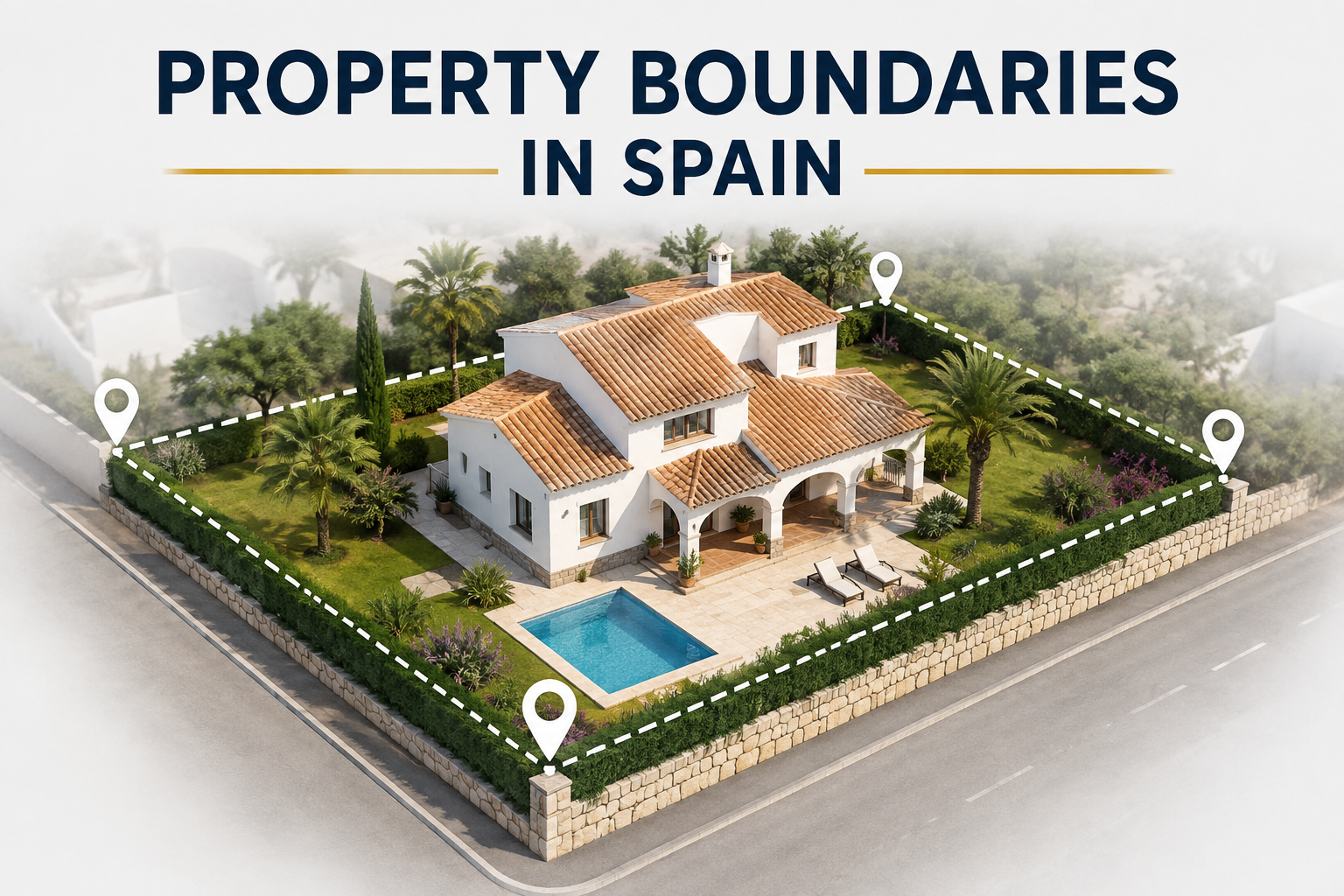
Property Boundaries in Spain: A Complete Guide for Benissa Property Owners and Buyers
Buying or selling property in Spain can become complicated when the boundary you can see on the ground does not perfectly match the information in the Catastro, Registro de la Propiedad or escritura.
This matters particularly with older fincas, rustic land and larger rural properties around Benissa. An old stone wall in Pedramala, a fence around a finca in Benimarco or an agricultural track between two parcels may look like an obvious boundary, but a physical feature does not automatically establish the legal extent of ownership.
The safest way to check property boundaries in Spain is to compare several sources: the physical property, the cadastral parcel, the registered finca, the title deed and, where necessary, a professional georeferenced survey.
This guide explains how those systems work, why discrepancies occur, how to investigate cadastral boundaries in Spain, what georeferenced coordination means, what procedures may be available when records need correcting, and what buyers and sellers in Benissa should check before committing to a transaction.
Expert Tip
Never rely solely on a fence, wall or cadastral map to establish exactly what land you own or are buying. Compare the Catastro, Registro, escritura and physical property, and obtain professional advice where a discrepancy could affect ownership, construction or the transaction.
At a Glance: How to Check Property Boundaries in Spain
A practical boundary investigation normally follows this sequence:
Catastro → Registro → Escritura → Physical inspection → Survey if necessary → Legal or administrative action where required
Each source has a different purpose.
| Source | What it tells you | What it does not automatically prove |
|---|---|---|
| Catastro | Cadastral parcel, reference, mapped geometry and cadastral information | By itself, it does not settle every ownership dispute |
| Registro de la Propiedad | Registered finca, ownership and registered rights | A nota simple is informative, not a formal certification |
| Escritura | Documentary description, surface, boundaries and transaction history | An old description may not correspond precisely to modern mapping |
| Physical inspection | Where walls, fences, gates, tracks and structures actually are | A physical feature does not automatically establish legal ownership |
| Topographical survey | Physical and georeferenced measurements | A survey measures land; it does not by itself determine legal ownership |
| Coordinated graphical representation | A georeferenced representation incorporated and coordinated through the Registry/Catastro system | Coordination does not make every planning or building issue disappear |
The key principle is simple:
A discrepancy is a reason to investigate, not automatically proof that someone is wrong.
What Are Property Boundaries in Spain?
What does a property boundary actually mean?
A property boundary is the line that defines the extent of a property or parcel of land.
In everyday language, the question is straightforward:
Where does this property end and the neighbouring property begin?
In Spain, however, the answer may involve several different pieces of information:
-
a parcela catastral;
-
a finca registral;
-
the description contained in an escritura;
-
named neighbouring properties or linderos;
-
a physical wall, fence or other feature;
-
and, where applicable, a georeferenced graphical representation.
These sources can all agree perfectly. But they do not necessarily have the same origin, purpose or history.
Parcel versus registered property
A parcela catastral is a parcel identified within the cadastral system.
A finca registral is the property recorded in the Registro de la Propiedad.
The two may correspond, but they are not simply two names for exactly the same thing.
This distinction is particularly important when buying rural property. A buyer should establish not only the cadastral parcel number, but also which registered finca is being transferred and whether the different descriptions correspond to the same physical land.
Why "where the property appears to be" and "where the legal boundary is" can differ
Imagine an older finca in the Benissa countryside.
There may be:
-
an old stone wall;
-
olive trees planted along the perimeter;
-
an agricultural track;
-
a gate that has been used for decades;
-
an escritura describing neighbouring properties by name;
-
and a modern cadastral line that does not perfectly follow the physical wall.
The physical appearance can provide valuable evidence about how the property has traditionally been occupied and used.
It does not automatically settle the legal question.
This is why boundary problems often remain unnoticed until an owner tries to sell, build, install a swimming pool, divide land or resolve a dispute with a neighbour.
Physical boundaries vs legal boundaries
Physical boundaries can include:
-
stone walls;
-
concrete walls;
-
wire fences;
-
hedges;
-
roads;
-
agricultural tracks;
-
drainage channels;
-
trees;
-
natural features;
-
gates;
-
boundary markers;
-
historic structures.
They are important evidence.
But:
A physical boundary is not automatically a legal boundary.
A wall may have been constructed after the original parcel was created. A fence may have been installed by a previous owner for convenience. A track may have existed historically without representing the exact legal division between two properties.
Spanish registry decisions have repeatedly dealt with situations in which physical features such as walls, fences and markers cannot, by themselves, establish the legal boundary.
Why property boundaries matter
Boundary information can affect:
-
ownership;
-
the land actually being purchased;
-
financing;
-
planning;
-
construction;
-
walls and fences;
-
access;
-
easements;
-
future subdivision;
-
neighbour relationships;
-
and the ability to sell a property without unexpected complications.
For a large rustic property, a relatively small boundary discrepancy can become significant if it changes the available plot area or affects where a proposed house, pool or extension can be located.
How Are Property Boundaries Defined in Spain?
No single document should automatically be treated as the complete answer to every boundary question.
The different sources need to be compared.
The escritura: the property title deed
The escritura pública is the public deed documenting a property transaction or another legal act.
Depending on its age and content, it can contain:
-
the property description;
-
surface area;
-
boundaries or linderos;
-
neighbouring properties;
-
location;
-
acquisition details;
-
previous owners;
-
and references to earlier documentation.
Older rural deeds can be particularly important.
A historic escritura might describe a property using neighbouring owners, roads, paths, ravines or other landmarks rather than modern coordinates.
For example:
North: property belonging to a named neighbour
South: camino
East: another finca
West: ravine
That information can be valuable, but converting a historic description into a precise modern boundary may require professional interpretation.
Important
A difference between an old escritura and modern Catastro does not automatically mean that either document is wrong. The history of the property needs to be investigated.
The Registro de la Propiedad
The Registro de la Propiedad records registered rights relating to property.
A finca registral has its own registered identity, and the Registry can record matters including:
-
ownership;
-
usufructs;
-
restrictions;
-
other registered rights;
-
and the registered description of the property.
A nota simple is commonly used during property due diligence. The Colegio de Registradores explains that it provides informative details about the registered finca, its owners and registered rights and limitations. It also makes clear that a nota simple is informative and does not itself certify the contents of the Registry.
The Registry can also incorporate a georeferenced graphical representation of a property.
That is important because:
having a cadastral reference is not the same as having a finca whose graphical representation is coordinated with Catastro.
The Catastro
The Catastro Inmobiliario is Spain's cadastral system.
It provides information about cadastral parcels and properties, including:
-
cadastral reference;
-
parcel geometry;
-
surface area;
-
location;
-
buildings and other physical characteristics.
The cadastral map is particularly useful for understanding how a parcel is represented geographically.
For property owners and buyers, the certificación catastral descriptiva y gráfica can be especially useful because it combines descriptive and graphical information.
The Catastro also provides tools for comparing cadastral information with alternative georeferenced representations and for supporting coordination with the Registro.
Georeferenced property boundaries
A georeferenced boundary represents the position and shape of land using geographic coordinates.
Instead of relying only on a written description such as:
"The northern boundary adjoins the property of X",
the property can be represented as a defined polygon whose vertices have coordinates.
This is particularly valuable for irregular rural properties.
Spanish property legislation introduced a modern system for incorporating georeferenced graphical representations into the Registro and coordinating them with Catastro. Article 9 of the Ley Hipotecaria provides for georeferenced graphical representation in the Registry in the circumstances established by law.
What does coordination mean?
When a finca's graphical representation has been incorporated into the Registry and coordinated with the cadastral representation, the system provides significantly greater certainty about the property's location, boundaries and surface.
The Catastro explains that coordination is specifically designed to improve certainty around the location, delimitation and surface area of registered properties.
This is why a buyer should not ask only:
"Does the property have a cadastral reference?"
A more useful question is:
"Is the registered finca graphically coordinated with Catastro?"
Catastro vs Registro de la Propiedad: What Is the Difference?
This is one of the most important concepts to understand when checking property boundaries in Spain.
| Catastro | Registro de la Propiedad | |
|---|---|---|
| Main function | Cadastral information and mapping | Registration of property rights |
| Identifies | Parcela catastral | Finca registral |
| Main reference | Referencia catastral | CRU / finca registral |
| Mapping | Cadastral cartography | Graphical representation where incorporated |
| Ownership | Not its primary function | Records registered ownership |
| Surface | Cadastral surface | Registered surface |
| Boundaries | Cadastral geometry | Registered description and, where applicable, georeferenced representation |
| Coordination | Can coordinate with Registro | Can record coordinated graphical representation |
| Practical use | Understanding the cadastral parcel | Due diligence concerning registered property and rights |
What information does Catastro provide?
The Catastro can help answer:
-
Which parcel is being identified?
-
What is its cadastral reference?
-
What surface does the cadastral system show?
-
What shape does the parcel have?
-
Where does the cadastral boundary appear to run?
-
What neighbouring cadastral parcels are shown?
For a buyer, this is essential information.
It is not, however, a substitute for checking the registered title.
What information does the Registro provide?
The Registro helps establish the registered legal position of the finca.
A nota simple can provide information about:
-
registered ownership;
-
CRU;
-
registered rights;
-
mortgages;
-
restrictions;
-
the registered description;
-
and, where relevant, the cadastral relationship of the finca.
The official Registry guidance confirms that the nota simple has informative value and identifies the registered finca, rights holders and the nature and limitations of those rights.
Why can Catastro and Registro show different information?
Several situations can produce discrepancies:
-
Historic descriptions were created before modern georeferencing.
-
A previous subdivision or alteration was not reflected consistently.
-
The cadastral map was updated at a different time.
-
Different methods of measuring surface were used.
-
A property was inherited or divided over several generations.
-
The physical property changed.
-
The Registry does not yet contain a coordinated graphical representation.
-
The cadastral parcel and registered finca have not been properly matched.
-
There may be a genuine discrepancy requiring correction.
The important point is that the existence of a discrepancy does not, by itself, tell you which source is wrong.
Is the Catastro map legally binding?
The answer is more nuanced than a simple yes or no.
An ordinary cadastral map should not be treated as a standalone answer to an ownership dispute.
However, when a cadastral graphical representation is incorporated into the Registro and the finca becomes coordinated with Catastro, Spanish law gives that coordinated representation a much stronger legal status regarding the location, boundaries and surface of the property. The Catastro describes coordination as providing legal certainty around these elements.
The distinction is therefore crucial:
Cadastral reference ≠ automatically coordinated property.
How to Check Property Boundaries in Spain
A practical boundary investigation can be divided into seven core steps, with additional professional checks where necessary.
Step 1: Find the cadastral reference
Identify the property's referencia catastral.
This allows you to locate the cadastral parcel and retrieve relevant cadastral information.
Do not stop here.
The cadastral reference identifies the parcel; it does not remove the need to check the registered finca and title documents.
Step 2: Check the cadastral map
Examine:
-
parcel shape;
-
surface;
-
neighbouring parcels;
-
access;
-
buildings;
-
unusual angles;
-
apparent overlaps;
-
and the relationship between the mapped boundary and the physical property.
Zoom in carefully.
A line that appears correct at a broad scale can look quite different when examined at parcel level.
Step 3: Review the escritura
Compare the title deed against the cadastral information.
Look at:
-
surface;
-
boundaries;
-
neighbouring properties;
-
location;
-
historic descriptions;
-
previous transactions.
Do not compare only the number of square metres.
The shape and identity of the land can be just as important as the area.
Step 4: Obtain a nota simple
Obtain a current nota simple from the relevant Registro de la Propiedad.
Check:
-
registered owner;
-
finca registral;
-
CRU;
-
registered surface;
-
property description;
-
mortgages;
-
rights and restrictions;
-
graphical information where available;
-
and whether the finca is identified or coordinated with Catastro.
Remember that a nota simple is informative rather than a formal certification of the Registry's contents.
Step 5: Compare the information
Now compare:
Catastro ↔ Registro ↔ escritura ↔ physical property
This is the point at which discrepancies become meaningful.
| Finding | What it may mean | Sensible response |
|---|---|---|
| All sources broadly agree | Low apparent boundary risk | Continue normal due diligence |
| Catastro surface differs slightly | Historic or measurement difference possible | Establish the reason |
| Escritura and Registry differ | Documentary/history issue possible | Review title history |
| Wall differs from cadastral line | Physical/documentary discrepancy | Investigate before altering anything |
| Registered and cadastral parcels appear different | Identity/correspondence issue | Professional review |
| Boundary affects proposed building | Potential planning consequence | Survey and planning review |
| Neighbour disputes the line | Potential legal dispute | Survey and legal advice |
Step 6: Inspect the physical boundaries
Walk the perimeter where possible.
Look for:
-
walls;
-
fences;
-
gates;
-
tracks;
-
neighbouring buildings;
-
terraces;
-
swimming pools;
-
extensions;
-
agricultural structures;
-
trees or hedges;
-
boundary markers;
-
signs of possible encroachment.
Take photographs.
For a rural property, inspect the whole perimeter, not only the area immediately surrounding the house.
Step 7: Get a professional survey if necessary
A survey becomes particularly appropriate where:
-
documents conflict;
-
the plot is large or irregular;
-
a boundary is unclear;
-
a neighbour disputes the line;
-
construction is planned;
-
a pool is planned close to a boundary;
-
the purchase depends on a minimum plot size;
-
there is a suspected encroachment;
-
or the exact surface materially affects the transaction.
What Is a Topographical Survey in Spain?
A topographical survey measures physical features and can produce precise georeferenced information about the land.
It is different from looking at a satellite image or measuring a garden with a tape measure.
What does a surveyor actually measure?
Depending on the purpose, a surveyor may measure:
-
property perimeter;
-
walls;
-
fences;
-
gates;
-
roads;
-
tracks;
-
buildings;
-
swimming pools;
-
terrain;
-
boundary markers;
-
and other relevant physical features.
The scope should be agreed before commissioning the work.
How are property boundaries measured?
The surveyor measures physical points and relates them to a recognised coordinate system.
The resulting information can then be compared with:
-
Catastro;
-
Registro;
-
escritura;
-
previous plans;
-
and physical features.
A survey provides technical evidence.
It does not automatically determine legal ownership.
That distinction is important.
What are coordinates and georeferencing?
Coordinates give a precise geographic position.
A georeferenced boundary therefore identifies where the perimeter sits geographically rather than describing it only in words.
For cadastral/Registry purposes, the relevant technical representations use official geodetic reference systems and can be supplied in digital formats such as GML.
What is a GML file?
A GML file is a digital file used to describe georeferenced geographic information.
For property boundaries, it can contain the coordinates defining the parcel geometry.
The Catastro uses GML-based information when working with Representación Gráfica Alternativa (RGA) and the associated Informe de Validación Gráfica Alternativa (IVGA).
For most buyers, the important point is simple:
You do not need to understand the technical structure of GML to benefit from a georeferenced survey.
A qualified surveyor or other appropriate professional can prepare the technical information when required.
When should a buyer commission a survey?
Consider one before purchasing when:
-
the land is large;
-
the boundary is unclear;
-
the documents disagree;
-
the property is rustic;
-
the buyer intends to build;
-
a pool is planned;
-
a minimum plot area matters;
-
or a neighbour's land appears to overlap.
The earlier the issue is identified, the easier it is to make an informed purchase decision.
When should a seller commission a survey?
A seller may benefit from resolving a significant boundary uncertainty before marketing the property.
This can reduce the likelihood of a buyer discovering the problem after an offer has been accepted.
Not every discrepancy needs to be corrected before listing. The decision depends on its significance and whether it affects ownership, construction, access, value or the transaction itself.
How much does a property survey cost?
There is no reliable universal price for a property boundary survey in Benissa.
The cost depends on factors including:
-
plot size;
-
terrain;
-
accessibility;
-
location;
-
complexity;
-
number of boundaries;
-
available documentation;
-
neighbouring properties;
-
and whether the survey needs to support a formal cadastral or Registry procedure.
A simple urban plot and a large irregular finca in the Benissa countryside are very different surveying projects.
Always obtain a property-specific quotation.
What Is a Representación Gráfica Alternativa, or RGA?
A Representación Gráfica Alternativa (RGA) is a georeferenced graphical representation proposed when the cadastral representation does not correspond with the physical reality or when a land operation requires an alternative graphical representation.
It can become relevant for matters such as:
-
certain parcel divisions;
-
segregations;
-
aggregations;
-
groupings;
-
reparcelling;
-
deslinde;
-
and correction of certain cadastral discrepancies.
The Catastro states that an RGA is used where the proposed parcel configuration differs from the existing cadastral representation and that an associated validation process is required in the relevant cases.
What is an Informe de Validación Gráfica Alternativa?
The IVGA is the electronic report generated from the alternative graphical representation.
It provides:
-
a georeferenced plan;
-
the coordinates defining the proposed geometry;
-
a CSV verification code;
-
and associated digital information.
The Catastro explains that the IVGA checks whether the alternative representation satisfies the relevant technical requirements and its compatibility with cadastral cartography.
Important limitation
An IVGA does not by itself confirm that the underlying legal transaction or planning operation is legally authorised.
The Catastro expressly states that graphical validation does not validate whether the legal operation creating the new parcel configuration complies with all applicable legal requirements or has obtained the necessary administrative authorisations.
That distinction is critical.
A technically valid graphical representation is not the same thing as legal approval of the underlying transaction.
How Do Cadastral Corrections and Registry Corrections Differ?
This is an important distinction that is often overlooked.
Correcting Catastro
If the cadastral description does not correspond with reality, there are administrative procedures for dealing with cadastral discrepancies.
The appropriate procedure depends on why the cadastral information is incorrect and what type of alteration is involved.
In some cases, a georeferenced alternative representation and IVGA are required.
Correcting the Registro
Correcting or completing the registered description is a separate matter.
The Ley Hipotecaria provides several mechanisms for incorporating or rectifying the graphical and descriptive information of a registered finca.
The correct route depends on the circumstances.
Why this matters
You can therefore have:
-
a cadastral issue;
-
a Registry issue;
-
a title-document issue;
-
or several of these at the same time.
Correcting one database does not automatically resolve every other discrepancy.
What Are Articles 199 and 201 of the Ley Hipotecaria?
International buyers often encounter these provisions when a property's registered description and graphical representation need to be clarified.
Article 199: graphical representation and coordination
Article 199 of the Ley Hipotecaria provides a procedure through which the registered owner can complete the description of a finca by establishing its graphical location and delimitation and, through that, its boundaries and surface.
Where the cadastral representation is used, the relevant cadastral certification can be incorporated.
Where an alternative graphical representation is proposed, the procedure includes additional safeguards, including notification to affected adjoining cadastral owners.
The Registrar must also consider whether there are doubts concerning the identity of the finca, including possible overlap with another registered graphical representation or public land.
Can a neighbour object?
Yes.
In an Article 199 procedure involving an alternative graphical representation, affected adjoining owners can be notified and may make representations.
But an objection does not automatically mean the proposed representation must be rejected.
The Registrar assesses the circumstances and the evidence. Recent Directorate-General decisions confirm that the mere opposition of someone who is not an affected registered owner does not automatically determine the outcome, while genuine evidence of a boundary dispute can prevent registration.
This is why a disputed boundary should be treated differently from a simple administrative discrepancy.
Article 201: rectification of the registered description
Article 201 deals with procedures for rectifying the description of registered properties, including circumstances involving surface and georeferenced representation.
The appropriate procedure depends on the nature of the correction and the circumstances of the finca.
Recent Registry decisions continue to apply Article 201 in conjunction with Articles 9 and 199 when dealing with changes to registered surface, boundaries and graphical representation.
What does this mean for a buyer?
It means that if you discover:
"The escritura says 10,800 m², Catastro says 11,500 m² and the Registry says something else",
you should not attempt to decide which figure is correct simply by looking at the cadastral map.
A professional may need to determine:
-
whether all documents refer to the same land;
-
whether the physical boundary is identifiable;
-
whether a graphical representation should be incorporated;
-
whether the cadastral record needs correction;
-
whether the Registry description needs rectification;
-
whether adjoining owners must be notified;
-
and whether the discrepancy has planning or ownership consequences.
What If the Catastro Boundary Does Not Match the Physical Boundary?
This is one of the most common situations that requires careful investigation.
Common reasons for a discrepancy
Possible explanations include:
-
historic mapping;
-
old fences or walls;
-
different measurement methods;
-
previous subdivisions;
-
property inheritance;
-
changes not reflected consistently;
-
cadastral mapping issues;
-
or a genuine boundary dispute.
The fence or wall appears to be in the wrong place
Suppose the cadastral line appears two metres inside an old stone wall.
Do not immediately conclude:
"The neighbour has taken two metres."
The wall could have been:
-
incorrectly positioned;
-
built after the original parcel was established;
-
constructed for practical reasons;
-
based on a historic understanding;
-
or unrelated to the precise legal boundary.
The correct approach is to investigate the evidence.
The cadastral map appears inaccurate
If the cadastral representation appears not to correspond with reality, a professional may prepare an alternative georeferenced representation.
The Catastro provides procedures for generating an RGA and IVGA and explains that these can be used in appropriate discrepancy and parcel-alteration procedures.
The correct route depends on the circumstances.
The property's historic boundary has changed
Older properties can have complicated histories involving:
-
inheritance;
-
division among family members;
-
segregation;
-
aggregation;
-
sales of portions of land;
-
changes to access;
-
and historical descriptions.
A modern cadastral parcel may therefore need to be compared with older deeds and title history.
The surface area differs but the boundary appears correct
A difference in area does not automatically mean the physical boundary is disputed.
Two documents can describe essentially the same land while reporting different areas.
The important questions are:
-
Are they referring to the same property?
-
Does the geometry correspond?
-
Is the difference material?
-
Does it affect planning?
-
Does it affect the transaction?
-
Is the graphical representation coordinated?
What should you do when you discover a discrepancy?
Investigate before altering anything.
Do not:
-
move a fence;
-
demolish a wall;
-
rebuild a boundary;
-
remove a gate;
-
confront a neighbour;
-
or advertise the larger surface
until the discrepancy is understood.
What If the Escritura, Catastro and Registro Do Not Match?
Why these discrepancies occur
Property information can have been created at different times and for different purposes.
An older escritura may contain a descriptive boundary written decades ago. The cadastral map may have subsequently changed. The Registry may still contain a historic textual description or may not yet have a coordinated graphical representation.
The discrepancy must therefore be interpreted rather than simply counted.
Which documents should be compared?
For a meaningful boundary investigation, compare:
-
Current Catastro information.
-
Current Registro information.
-
Escritura.
-
Previous deeds where relevant.
-
Physical boundaries.
-
Any existing survey.
-
Relevant planning or subdivision documentation.
-
Any evidence concerning historic boundary agreements or disputes.
Does a larger cadastral area mean you own more land?
No, not automatically.
If Catastro shows 11,500 m² and the escritura shows 10,800 m², you should not simply assume that the additional 700 m² belongs to the property.
The discrepancy may be administrative, historical, technical or legal.
The same principle applies in reverse.
Never assume that the smallest figure is automatically the legally correct one either.
When is a professional survey necessary?
A survey becomes particularly useful when the discrepancy affects:
-
ownership;
-
plot size;
-
construction;
-
pool location;
-
access;
-
financing;
-
valuation;
-
a neighbour;
-
or the decision to purchase.
When should you involve a lawyer?
Legal advice is appropriate where the issue involves:
-
disputed ownership;
-
a neighbour's claim;
-
an apparent encroachment;
-
conflicting title documents;
-
potential litigation;
-
a formal boundary procedure;
-
registered rights;
-
or a transaction that could be affected.
A surveyor and lawyer have different roles.
The surveyor investigates the physical and georeferenced position of the land.
The lawyer assesses the legal consequences and appropriate legal procedure.
Who Should You Contact About a Boundary Problem?
International buyers often waste time because they approach the wrong professional first.
| Problem | Appropriate professional or authority |
|---|---|
| Initial discrepancy identified during a sale | Estate agent can flag and coordinate the issue |
| Physical boundary measurement | Surveyor/topographer |
| Georeferenced parcel representation | Qualified technical professional |
| Cadastral discrepancy | Catastro procedure, often with technical/professional assistance |
| Registered ownership question | Registro de la Propiedad |
| Legal ownership dispute | Property lawyer |
| Neighbour boundary dispute | Surveyor + property lawyer |
| Formal notarial procedure | Notary |
| Registry application | Registro, usually through the relevant legal/notarial process |
| Building or pool implications | Architect/planning professional |
| Planning legality | Relevant planning authority and qualified professional |
The estate agent's role is to identify questions and help coordinate the transaction.
It is not to replace a surveyor, lawyer, architect, notary, Catastro or Land Registry.
That distinction is important for trustworthy property advice.
What Are Deslinde and Amojonamiento?
These Spanish terms are particularly relevant when a boundary is genuinely uncertain.
What does deslinde mean?
Deslinde refers to determining the boundary between adjoining properties.
The Spanish Civil Code recognises an owner's right to seek the demarcation of their property, with adjoining owners involved in the process. The Code also contains rules concerning titles and, where titles are insufficient, possession and other evidence.
In simple terms:
Deslinde is about determining where the boundary is.
What does amojonamiento mean?
Amojonamiento refers to physically marking or identifying an established boundary, traditionally through boundary markers or mojones.
A useful way to remember the distinction is:
-
Deslinde = determining the boundary.
-
Amojonamiento = marking the boundary.
The two can be connected, but they are not identical.
When might a formal boundary determination be necessary?
It may become relevant when:
-
neighbouring owners disagree;
-
the documentary evidence is insufficient;
-
the boundary is genuinely uncertain;
-
the graphical representation needs to be established;
-
or the exact boundary has important legal consequences.
A formal process can be considerably more involved than correcting a simple cadastral error.
What happens when neighbouring owners agree?
Agreement between neighbours can simplify matters considerably.
However, an informal statement such as:
"We've always considered the wall to be the boundary"
should not automatically be treated as equivalent to a properly documented legal arrangement.
Where the boundary has significant legal or transactional importance, obtain professional advice on how the agreement should be formalised.
What happens when neighbouring owners disagree?
The situation becomes more serious.
Relevant evidence may include:
-
title deeds;
-
Registry records;
-
cadastral information;
-
surveys;
-
historic documents;
-
photographs;
-
possession;
-
agreements;
-
and evidence concerning neighbouring properties.
The appropriate legal procedure depends on the circumstances.
Property Boundary Disputes Between Neighbours in Spain
Boundary disputes often begin with something apparently minor.
Common causes of boundary disputes
Typical issues include:
-
fences;
-
walls;
-
extensions;
-
swimming pools;
-
terraces;
-
encroachments;
-
access roads;
-
historic boundaries;
-
trees and hedges;
-
gates;
-
drainage;
-
agricultural structures.
A problem may remain unnoticed for many years until one owner decides to sell or build.
What should you do if your neighbour disputes the boundary?
Remain factual.
Collect:
-
photographs;
-
Catastro information;
-
Registry information;
-
escritura;
-
previous deeds;
-
existing surveys;
-
correspondence;
-
and any historic agreements.
Do not immediately escalate the situation.
If the issue concerns physical location, a surveyor may provide useful evidence. If it concerns ownership or legal rights, involve a lawyer.
Should you move or remove a fence?
No — not simply because a map appears to support your position.
This is one of the most important practical rules in a boundary dispute.
A fence may have existed for decades. Moving it without first establishing the legal and technical position could make the dispute considerably worse.
Spanish registry decisions have specifically considered the evidential value of physical features and the need to assess the wider circumstances rather than treating a wall, fence or marker as automatically conclusive.
When should you involve a surveyor?
Use a surveyor when the dispute concerns the physical location of the boundary.
The survey can provide objective technical evidence.
When should you involve a lawyer?
Use a lawyer when the issue concerns:
-
ownership;
-
legal rights;
-
registered property;
-
neighbour claims;
-
potential litigation;
-
formal boundary procedures;
-
or a transaction affected by the dispute.
Property Boundaries and Building in Benissa
Boundary verification should happen before architectural design, not after.
Why boundaries matter before building
The position of the boundary can affect:
-
where a house can be placed;
-
available building area;
-
setbacks;
-
access;
-
pool location;
-
extensions;
-
walls;
-
landscaping;
-
and planning feasibility.
A few metres can materially change the usable area of an irregular plot.
Building setbacks and boundaries
The applicable planning requirements depend on the location, planning classification and project.
A boundary question should therefore be considered alongside planning requirements rather than separately.
For a Benissa property, this can be especially important when a buyer intends to develop or substantially renovate a property.
Swimming pools and property boundaries
Swimming pools are a common example of why the boundary matters.
A garden may look large enough for a pool, but if the actual property perimeter is different from the assumed one, the available area may be reduced.
Before committing to a pool design, verify the boundary and applicable planning requirements.
Walls and fences
Before constructing or replacing a boundary wall or fence, check:
-
the location of the boundary;
-
neighbouring rights;
-
access;
-
easements;
-
planning requirements;
-
and any existing dispute.
Extensions and new construction
An existing extension close to a boundary deserves particular attention when buying an older property.
Do not assume:
"It has been there for years, so everything is automatically legal."
Boundary location and building legality are separate questions, although they can affect one another.
Why boundary verification should happen before architectural work
Architectural plans based on an incorrect perimeter can result in:
-
redesign;
-
additional professional fees;
-
delays;
-
planning problems;
-
or a project that cannot be built as originally intended.
The sensible sequence is:
Confirm the land → confirm planning parameters → design the project.
Not:
Design the project → discover the boundary problem.
How Property Boundaries Affect Rustic Land in Benissa
Benissa includes established residential areas as well as extensive countryside, with properties in places such as Pedramala, Benimarco, Buenavista, Fanadix and parts of Benissa Costa presenting very different physical and documentary characteristics.
Older rural properties can have:
-
larger parcels;
-
irregular shapes;
-
agricultural tracks;
-
historic stone walls;
-
old boundary descriptions;
-
inherited land;
-
previous divisions;
-
and structures built at different points in the property's history.
This does not make rustic property inherently problematic.
It means the documentary history and physical reality deserve particular attention.
Why boundaries matter when buying rustic land
The total area of a rustic property can be important to a buyer's plans.
But the buyer should not simply assume:
"The seller says the property has 11,000 m², therefore I have 11,000 m² of legally established land for every purpose."
The actual property identity, surface, planning classification and applicable regulations must be checked.
This is particularly important where the buyer's plans involve:
-
constructing a house;
-
extending an existing property;
-
installing a pool;
-
agricultural use;
-
planning permission;
-
financing;
-
or any decision based on a minimum plot area.
Warning
If the difference between two documents could affect whether you can build, finance or value the property, resolve the discrepancy before relying on the larger figure.
How to Check Property Boundaries in Benissa
Checking a Benissa property on the Catastro map
When reviewing a Benissa property, identify the cadastral parcel and compare it with what you can see on site.
Look carefully at:
-
parcel shape;
-
surface;
-
neighbouring plots;
-
roads;
-
agricultural tracks;
-
walls;
-
fences;
-
buildings;
-
pools;
-
terraces;
-
and unusual perimeter changes.
Satellite imagery can be useful as a visual aid, but it should not replace official cadastral and documentary checks.
Why older Benissa properties may require extra attention
A modern residential plot in an established urbanisation may be relatively straightforward.
An older finca may involve decades of property history.
For example, a property may have been:
-
inherited;
-
divided between family members;
-
sold in parts;
-
described using historic neighbours;
-
accessed through a traditional track;
-
surrounded by an old stone wall;
-
or represented differently in modern mapping.
The important question is not whether the property is old.
It is whether the current property identity and boundaries can be understood and supported by the available evidence.
What to look for when viewing a Benissa finca
When viewing a finca in Pedramala, Benimarco or another rural part of Benissa, walk beyond the house itself.
Check:
-
Boundary walls: do they appear continuous?
-
Fences: do they follow the apparent parcel?
-
Gates: where does access actually enter?
-
Tracks: do they cross the property?
-
Neighbouring structures: are any buildings, terraces or pools close to the boundary?
-
Apparent encroachments: does something appear to cross the line?
-
Parcel shape: does the physical property resemble the cadastral geometry?
-
Access: is the route to the property consistent with the documents?
-
Irregular corners: are there areas that are difficult to identify on the ground?
Take photographs during the viewing.
A few minutes spent inspecting the perimeter can identify questions that otherwise emerge much later.
Checking Property Boundaries Before Buying in Benissa
Boundary due diligence is particularly important when the land itself forms a major part of the property's value.
What to check before paying a reservation deposit
Before committing money, establish as much as reasonably possible about:
-
the property identity;
-
cadastral reference;
-
registered finca;
-
surface;
-
physical boundaries;
-
access;
-
neighbouring parcels;
-
apparent encroachments;
-
and material discrepancies.
If the purchase decision depends on the exact plot size or shape, make that clear before signing.
What to check during due diligence
Compare:
-
Catastro;
-
Registro;
-
escritura;
-
previous deeds where relevant;
-
physical boundaries;
-
planning information;
-
survey information;
-
and any relevant professional reports.
For rustic property, this broader review is particularly important.
What to verify before signing the purchase contract
If a boundary discrepancy is known, do not leave it as an unexplained verbal issue.
The buyer should understand:
-
what differs;
-
why it differs;
-
whether the land is the same in each document;
-
whether ownership is affected;
-
whether planning is affected;
-
whether the purchase price assumes a particular area;
-
who is responsible for resolving the issue;
-
and whether the transaction should proceed before resolution.
When should you commission a survey?
A survey is particularly sensible where:
-
the property is large;
-
the shape is irregular;
-
the purchase depends on exact surface;
-
the buyer plans to build;
-
a pool is planned;
-
a boundary is unclear;
-
or a neighbour's land appears to overlap.
The earlier this is established, the less likely it is that the buyer will spend money designing a project around incorrect assumptions.
Boundary warning signs buyers should not ignore
Pay particular attention to:
-
seller and Catastro showing different areas;
-
escritura and Registry showing different surfaces;
-
a wall that does not follow the cadastral line;
-
neighbouring structures apparently crossing the boundary;
-
unusual parcel shapes;
-
unclear access;
-
informal historic arrangements;
-
unexplained land outside the fenced area;
-
or a seller unable to explain a significant discrepancy.
Buyer Boundary Due Diligence Checklist
-
Cadastral reference checked
-
Cadastral map checked
-
Cadastral surface recorded
-
Escritura obtained
-
Nota simple obtained
-
CRU/finca registral checked
-
Registered surface checked
-
Surface areas compared
-
Physical boundaries inspected
-
Walls and fences checked
-
Gates and access checked
-
Neighbouring parcels checked
-
Apparent encroachments investigated
-
Boundary discrepancies explained
-
Graphical coordination checked where relevant
-
Survey obtained where appropriate
-
Planning implications checked
-
Legal advice obtained where necessary
-
Construction plans checked against the verified boundary
Buyer Warning
A cadastral map, property deed, Land Registry record and physical boundary can contain different information. A discrepancy does not automatically mean there is a legal problem — but it should be understood before you commit to the purchase.
Checking Property Boundaries Before Selling in Benissa
Boundary preparation is not only for buyers.
Sellers can often save time by identifying potential discrepancies before accepting an offer.
Why sellers should identify discrepancies early
Imagine a seller is marketing a rural property and the documents show:
-
Catastro: 12,000 m²;
-
escritura: 10,900 m²;
-
physical fenced area: apparently different.
If the buyer discovers this after an offer has been accepted, the issue may trigger legal enquiries, a survey or renegotiation.
If the seller already understands the discrepancy, the transaction can proceed from a much stronger position.
How boundary problems can delay a sale
A material issue can result in:
-
additional enquiries;
-
surveying costs;
-
legal review;
-
cadastral procedures;
-
Registry procedures;
-
renegotiation;
-
financing complications;
-
delayed contracts;
-
or a buyer withdrawing.
Not every discrepancy causes a delay.
The key question is whether it affects what the buyer believes they are purchasing.
What documents should sellers prepare?
Where available, prepare:
-
current escritura;
-
current nota simple;
-
cadastral information;
-
cadastral reference;
-
previous deeds where relevant;
-
existing survey;
-
plans;
-
relevant planning documentation;
-
boundary agreements;
-
and documentation concerning previous subdivisions or alterations.
Should a seller resolve a discrepancy before listing?
Not necessarily.
Some discrepancies are minor and can be explained.
Others are significant enough that resolving them before marketing may be sensible.
Consider:
-
Does it affect ownership?
-
Does it affect the plot area?
-
Does it affect construction?
-
Does it involve a neighbour?
-
Does it affect value?
-
Could it affect financing?
-
Is the discrepancy likely to concern a buyer's lawyer?
The answer should determine the next step.
How Telio Homes can help identify potential issues early
A local estate agent cannot replace a lawyer, surveyor, architect, notary or public authority.
However, a Benissa-focused estate agent can identify obvious questions during the initial property review.
A sensible pre-marketing check is:
What the owner says → what the documents say → what Catastro shows → what is physically visible
If something does not make sense, it is better to identify the question early and refer it to the appropriate professional.
This is particularly valuable with rural properties where the documentary history may be more complex.
Real-Life Boundary Examples from Benissa
The following examples are fictionalised scenarios, included to demonstrate how boundary issues can arise. They are not descriptions of specific Telio Homes client cases.
Example 1: An old stone wall around a finca
Problem:
An old stone wall around a finca in the Benissa countryside does not perfectly follow the cadastral line.
Incorrect assumption:
"The wall has been here for decades, so it must be the legal boundary."
Better approach:
Compare the wall with the escritura, Registry, Catastro, historic documents and, if necessary, a survey.
Lesson:
A physical boundary is evidence, not automatically conclusive proof of ownership.
Example 2: Catastro shows 11,500 m² but the escritura shows 10,800 m²
Problem:
A buyer is attracted by the larger cadastral area.
Risk:
The buyer assumes the additional 700 m² automatically belongs to the property.
Next steps:
-
Confirm that both documents refer to the same property.
-
Compare the parcel geometry.
-
Check the registered finca.
-
Review historic deeds.
-
Inspect the physical perimeter.
-
Obtain a survey if the discrepancy matters.
-
Obtain legal advice if ownership is genuinely uncertain.
Lesson:
Never rely on the larger figure without understanding the discrepancy.
Example 3: A neighbour's fence appears to cross the cadastral boundary
Problem:
A fence appears to sit several metres inside the cadastral parcel.
Risk:
The buyer assumes the neighbour has encroached.
Better approach:
Document the situation and obtain professional evidence before moving the fence or confronting the neighbour.
Lesson:
An apparent cadastral encroachment requires investigation, not unilateral action.
Example 4: A buyer wants to build a pool
Problem:
The garden appears large enough for a pool, but the boundary is uncertain.
Risk:
The proposed pool may need to be moved if the verified boundary is closer than expected.
Better approach:
Verify boundary → establish planning parameters → design pool
not:
Design pool → discover boundary problem
Lesson:
Boundary verification should happen before detailed architectural work.
Example 5: Historic family subdivision of a rustic finca
Problem:
An older finca was divided through historic family transactions, while modern mapping shows a different configuration.
Risk:
The current owner may rely on a traditional understanding of the land that does not correspond neatly with modern records.
Better approach:
Review the title chain, cadastral history, Registry information, physical occupation and any historic documentation.
Lesson:
Older rural properties can require additional documentary due diligence.
Example 6: The buyer's construction plan depends on a minimum plot size
Problem:
The seller states that a rustic parcel has sufficient surface for the buyer's intended project, but the escritura and Catastro show different areas.
Risk:
The buyer proceeds on the assumption that the larger figure is the relevant one.
Better approach:
Verify the property identity and legally relevant surface before spending significant money on architectural work.
Lesson:
Never base a construction decision solely on the largest area appearing in a property document.
Planning rules and development rights must be assessed separately by the appropriate professional.
A Practical Boundary Decision Tree
Use this framework when a discrepancy is discovered.
Do the documents and physical boundary broadly agree?
YES → Continue normal property due diligence.
NO → Investigate the discrepancy.
↓
Does the discrepancy affect ownership, surface, access or construction?
NO → Establish why the difference exists and whether an administrative correction is appropriate.
YES → Obtain professional technical and/or legal review.
↓
Is a neighbour involved?
NO → Continue with the appropriate cadastral/Registry process.
YES → Do not alter the physical boundary. Obtain evidence and legal advice where necessary.
↓
Is the property being bought or sold?
YES → Understand the discrepancy before making a binding commitment based on the disputed information.
Boundary Problem Severity: What Should You Do?
| Situation | Example | Recommended approach |
|---|---|---|
| Low | Small unexplained surface difference with no apparent practical effect | Establish the reason and document it |
| Medium | Fence or wall differs from cadastral line | Professional review |
| High | Neighbour claims part of the property | Survey + legal advice |
| Critical | Boundary affects purchase, buildability or a major project | Resolve or sufficiently understand before commitment |
The classification is a practical guide, not a legal definition.
Property Boundary Checklist for Buyers in Benissa
Documents
-
Cadastral reference checked
-
Cadastral map checked
-
Cadastral surface recorded
-
Escritura obtained
-
Nota simple obtained
-
CRU/finca registral identified
-
Registered surface checked
-
Previous documentation reviewed where necessary
-
Graphical coordination status checked where relevant
Physical inspection
-
Boundary walls inspected
-
Fences inspected
-
Gates inspected
-
Access checked
-
Tracks checked
-
Neighbouring structures checked
-
Pools and terraces checked
-
Apparent encroachments identified
-
Parcel shape compared with the map
Professional checks
-
Significant discrepancy investigated
-
Survey obtained where appropriate
-
Georeferenced information obtained where necessary
-
Planning implications checked
-
Legal advice obtained where necessary
-
Relevant cadastral/Registry procedure identified if correction is required
Before committing
-
Any material discrepancy explained
-
Boundary issue documented
-
Purchase price reflects the understood property
-
Reservation/purchase documentation deals appropriately with any unresolved issue
-
Construction assumptions are based on verified information
What to Do If You Discover a Boundary Problem
Minor cadastral discrepancy
If the difference is small and does not appear to affect:
-
ownership;
-
neighbouring property;
-
access;
-
construction;
-
or the commercial basis of the transaction,
establish why the difference exists.
Do not automatically dismiss it, but do not assume it is a major legal problem either.
Significant difference between documents
If Catastro, Registro and escritura show materially different information:
-
Confirm that all documents refer to the same property.
-
Review the historical documentation.
-
Compare the graphical representations.
-
Inspect the physical perimeter.
-
Obtain a survey where appropriate.
-
Obtain legal advice where ownership or registration is affected.
Physical boundary disagreement
If the documents point one way but the physical wall or fence points another:
-
photograph it;
-
document it;
-
do not move it;
-
obtain technical evidence;
-
and establish the legal position before taking action.
Neighbour dispute
If a neighbour actively claims part of the land, treat the issue as a potential legal dispute.
Do not assume that the cadastral map alone will settle it.
Boundary affects planned construction
If the boundary affects:
-
house position;
-
pool;
-
extension;
-
setbacks;
-
access;
-
or available building area,
resolve or sufficiently understand the issue before committing to detailed construction work.
Property is currently being bought or sold
If the property is already under negotiation, make the discrepancy known to the relevant professionals.
The buyer and seller should understand:
-
what the discrepancy is;
-
whether it affects the property being transferred;
-
whether it affects price;
-
whether it affects construction;
-
and whether it needs to be resolved before completion.
Frequently Asked Questions About Property Boundaries in Spain
How are property boundaries determined in Spain?
Property boundaries can be evidenced through title documents, registered information, cadastral graphical information, physical evidence and georeferenced surveying. Where there is uncertainty or disagreement, the appropriate cadastral, Registry, notarial or legal procedure may be required.
How can I check my property boundaries in Spain?
Start with the cadastral reference and map. Then compare Catastro with the escritura, Registro de la Propiedad and the physical property. If there is a meaningful discrepancy, consider a professional survey and legal advice.
Is the Catastro map legally binding?
An ordinary cadastral map should not be treated as a standalone answer to every ownership dispute. When the cadastral graphical representation is incorporated into the Registry and the finca is coordinated with Catastro, the coordinated representation has significantly stronger legal effect regarding location, boundaries and surface.
What is the difference between Catastro and the Registro de la Propiedad?
Catastro is Spain's cadastral information and mapping system. The Registro de la Propiedad records registered ownership and property rights. They are separate systems that can be coordinated.
Which is more important, Catastro or Registro?
They serve different purposes. The Registro is particularly important for registered ownership and rights, while Catastro is essential for cadastral identification and mapping. Where a finca is graphically coordinated, the coordinated representation has additional legal significance.
Why do Catastro and Registro sometimes show different property sizes?
Historic descriptions, previous alterations, different measurement methods, changes in mapping and lack of graphical coordination can all produce differences. The discrepancy should be investigated rather than automatically assuming that one institution is wrong.
Does a fence prove where my property boundary is?
No. A fence can provide useful physical evidence but does not automatically establish legal ownership. Spanish Registry decisions have considered situations where physical signs such as walls and fences did not, by themselves, determine the legal boundary.
What should I do if my neighbour disputes my boundary?
Do not move the fence or wall simply because you believe your documents support you. Collect the relevant evidence, consider a survey and seek legal advice where the dispute concerns ownership or registered rights.
What is a deslinde in Spain?
A deslinde is a process for determining the boundary between adjoining properties. The Spanish Civil Code recognises an owner's right to seek boundary demarcation and provides rules concerning titles, possession and evidence.
What is amojonamiento?
Amojonamiento refers to physically marking or identifying an established boundary, traditionally using boundary markers. It is related to boundary determination but is not the same as determining the legal boundary itself.
Do I need a surveyor to establish my property boundary?
Not always. If the documents and physical property are consistent, a separate survey may not be necessary. A survey becomes particularly useful when the property is large or irregular, documents conflict, construction is planned or a neighbour disputes the boundary.
Can I correct an incorrect cadastral boundary?
Potentially, yes, but the appropriate procedure depends on the circumstances. The Catastro provides mechanisms involving alternative georeferenced representations and validation where appropriate.
What is a Representación Gráfica Alternativa?
An RGA is an alternative georeferenced representation of parcel geometry proposed where the existing cadastral representation does not correspond with the intended or physical configuration in circumstances where such an alternative representation is appropriate. It can be used in various cadastral and Registry procedures.
What is an Informe de Validación Gráfica Alternativa?
An IVGA is an electronic report generated by the Catastro's validation service for an alternative georeferenced graphical representation. It checks technical compatibility with cadastral cartography. It does not, by itself, approve the legal transaction or planning operation underlying the proposed parcel change.
What is a GML file for a property?
GML is a digital format used to represent georeferenced geographic information. In cadastral work, it can contain the geometry and coordinates of parcels used in the relevant validation processes.
What is Article 199 of the Spanish Mortgage Law?
Article 199 of the Ley Hipotecaria provides a procedure for incorporating a georeferenced graphical representation into the registered description of a finca and coordinating it with Catastro. It contains safeguards concerning the identity of the property and, in relevant cases, notification to adjoining owners.
What is Article 201 of the Spanish Mortgage Law?
Article 201 provides procedures concerning the rectification of the registered description of a property, including circumstances involving surface and georeferenced representation. The correct procedure depends on the circumstances of the property and the correction required.
Can a surveyor change my cadastral boundary?
A surveyor can prepare technical measurements and, where appropriate, the georeferenced information needed for a cadastral or Registry procedure. The surveyor does not unilaterally decide legal ownership or simply move an official boundary by measuring the land.
Can a boundary be corrected without my neighbour agreeing?
It depends on the circumstances and the procedure involved. Certain Registry procedures include notification and an opportunity for affected adjoining owners to make representations. An objection does not automatically determine the outcome, but a genuine boundary dispute can prevent or complicate registration.
Can I build on land shown in Catastro but not in my escritura?
Do not assume so. If the additional land is relevant to construction, first establish the identity and legal status of the property and check the applicable planning rules. A cadastral surface figure alone should not be used as the sole basis for a building decision.
Can I sell a property if Catastro and Registro do not match?
A discrepancy does not automatically make a sale impossible. The practical question is what the discrepancy means and whether it affects the property being transferred, ownership, planning, financing or the buyer's due diligence. Significant discrepancies should be understood before completion.
Will a boundary discrepancy affect my mortgage?
It can, depending on the nature of the discrepancy and the lender's requirements. If the property identity, surface, registered information or planned use is unclear, the lender may require additional documentation or professional review.
Does a boundary discrepancy affect property value?
Potentially. If the discrepancy affects the land being sold, usable area, access, development potential or buyer confidence, it can influence valuation and marketability.
Should I check property boundaries before buying land in Spain?
Yes, especially where the exact plot size, shape, access or construction potential is important to the purchase. Boundary checks are particularly valuable for rustic and rural properties.
Why are boundaries particularly important for rustic properties in Benissa?
Older rural properties can have larger parcels, irregular shapes, historic walls, agricultural tracks, older documentation and more complicated ownership histories. In areas such as Pedramala and Benimarco, comparing the physical land with the documentary and cadastral information can therefore be particularly important.
Key Takeaways: Property Boundaries in Spain
If you remember only five things about property boundaries in Spain, remember these:
-
Never rely on a fence or wall alone. Physical features are evidence, not automatically conclusive proof of ownership.
-
Check Catastro and Registro separately. They have different functions.
-
Compare both with the escritura. Surface area alone is not enough; check identity, boundaries, neighbours and geometry.
-
Investigate meaningful discrepancies. A difference does not automatically mean there is a legal problem, but it should be understood.
-
Use the right professional for the problem. A surveyor can investigate physical and georeferenced information; a lawyer can assess legal rights and procedures; architects and planning professionals should address development implications.
For Benissa properties, particularly older fincas and rustic land, good boundary due diligence is part of understanding exactly what is being bought or sold.
Conclusion
Understanding property boundaries in Spain requires more than looking at a fence, opening a cadastral map or comparing two numbers on different documents.
The strongest approach is to compare the Catastro, Registro de la Propiedad, escritura and physical property, then use professional surveying, legal or planning advice where the discrepancy could affect the transaction or the intended use of the land.
This is particularly relevant in Benissa, where buyers can encounter everything from clearly defined plots in established residential areas to older fincas and rustic properties with historic boundaries, irregular parcel shapes and decades-old documentation.
A cadastral discrepancy does not automatically mean that a property is defective. Equally, an old stone wall should not automatically be assumed to establish the legal perimeter.
The objective is to establish:
-
what land the property actually comprises;
-
how that land is represented in Catastro;
-
how the finca is recorded in the Registro;
-
what the escritura says;
-
where the physical boundary lies;
-
whether the graphical information is coordinated;
-
and whether any discrepancy affects ownership, planning, construction, access, value or the transaction.
Where a discrepancy is material, the answer is not to choose whichever document gives the largest plot.
It is to investigate the discrepancy properly.
For buyers in Benissa, this can mean checking the boundary before paying a reservation deposit, before committing to a construction project and certainly before assuming that a particular plot size guarantees a particular development possibility.
For sellers, identifying a significant discrepancy before marketing can make the eventual transaction more transparent and reduce unpleasant surprises during due diligence.
If you are buying or selling property in Benissa, Benissa Costa, La Fustera, San Jaime, Fanadix, Buenavista, Benimarco or Pedramala, a local property specialist can help identify questions that should be investigated before the transaction progresses.
If you are considering selling, you can also request a property valuation and discuss whether the property's documentation, physical boundaries and cadastral information appear consistent before putting it on the market.
Spanish property, cadastral, planning and registration rules can change, and the correct procedure depends on the circumstances of the individual property. Where a boundary issue could affect ownership, construction, a neighbour's rights or a purchase or sale, seek advice from the appropriate qualified professional.
Official Sources and Legal References
The most authoritative sources for checking the information discussed in this guide are:
-
Dirección General del Catastro — official information on Catastro–Registro coordination, georeferenced representations, RGA, GML and IVGA. Dirección General del Catastro — Catastro/Registro Coordination
-
Sede Electrónica del Catastro — official cadastral services and property information. Sede Electrónica del Catastro
-
Colegio de Registradores de España — official information concerning the Registro de la Propiedad and nota simple. Colegio de Registradores — Registro de la Propiedad
-
Boletín Oficial del Estado — official publication of Spanish legislation and Registry resolutions. BOE — legislación española
The relevant legal framework includes, among other provisions, the Ley Hipotecaria, particularly Articles 9, 199 and 201, together with the Spanish Civil Code provisions concerning boundary demarcation. Current Registry resolutions continue to clarify how these provisions operate in individual cases.